Catalog Archive
Auction 104, Lot 245

"[A Map of Pennsylvania, and the Parts connected therewith, relating to the Roads and Inland Navigation…]", Howell, Reading

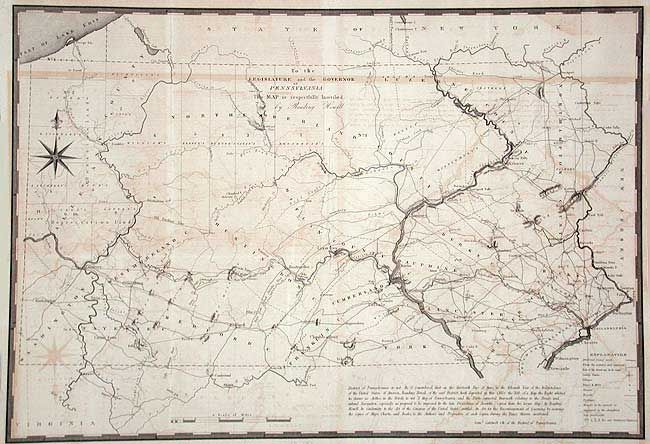
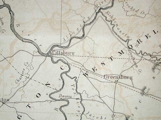
Subject: Pennsylvania

Period: 1834 (circa)

Publication:

Color: Black & White

Size:
26.4 x 17.8 inches
67.1 x 45.2 cm
Download High Resolution Image
(or just click on image to launch the Zoom viewer)

The map shows the entire state with remarkable detail for the time. Shows roads, watershed, county lines and topography. Most settlement is along the Delaware River and the southeastern portion, as well as around Pittsburgh. Locates the Old Purchase Line extending from the Allegheny River. Howell copied this map from his larger map of 1792. This issue is believed to be from the 1834 American State Papers.

References: cf Wheat & Brun 437; Phillips (M) pp. 678-79.

Condition: B

Issued folding, now backed with archival tissue. Offsetting throughout.

Estimate: $250 - $300

Sold for: $180

Closed on 9/10/2003

Archived