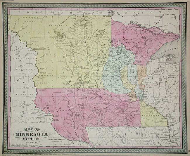
Subject: Minnesota and Dakota Territory
Period: 1853 (published)
Publication: Mitchell's New Universal Atlas
Color: Hand Color
Size:
16 x 12.8 inches
40.6 x 32.5 cm
Well-engraved map with county development limited to the extreme southern and eastern portions. Large region in west is labeled Pembina, while the large southern area is Dahkotah. Settlement is mostly along the Mississippi River. Locates many Indian tribes, including Assiniboine, Yanktonan, Chippeway, Mennomonees, Winebagoes, etc. Forts along the Missouri River include aux Cedres, Lookout, Pierre Choteau, Clarke, and Mandan (noted as the wintering place of Lewis and Clarke in 1804-05). Fancy titling and decorative borders. A detailed and interesting map that documents the early stages of development.
References:
Condition: A
Good impression with original pastel coloring.