Catalog Archive
Auction 104, Lot 176
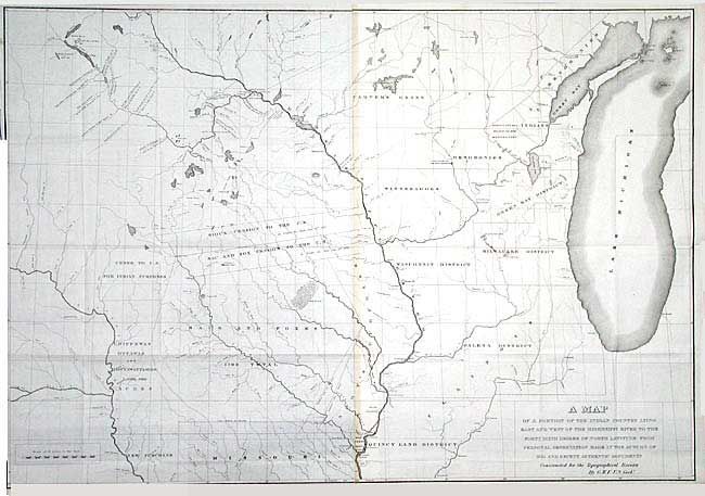
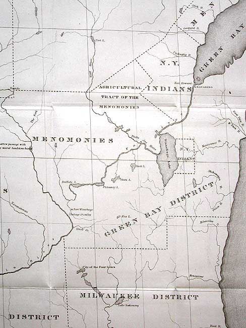
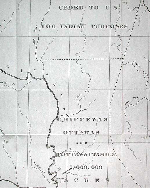
"A Map of a Portion of the Indian Country Lying East and West of the Mississippi River to the Forty Sixth Degree of North Latitude from Personal Observation Made in the Autumn of 1835 and Recent Authentic Documents…", U.S. Government
Subject: United States - Central
Period: 1836 (circa)
Publication: Report of a geological reconnaissance…to the Coteau de Prairie
Color: Black & White
Size:
37.9 x 26.2 inches
96.3 x 66.5 cm
Download High Resolution Image
(or just click on image to launch the Zoom viewer)
(or just click on image to launch the Zoom viewer)