Subject: Canada & United States
Period: 1786 (dated)
Publication: A New Atlas of the Mundane System…
Color: Hand Color
Size:
12.3 x 19 inches
31.2 x 48.3 cm
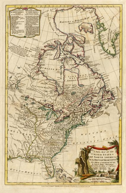
This map is based on the surveys of Captain Carver and was issued shortly after the founding of the United States. The western boundaries of most of the states are left open, but the U.S. extends to the Mississippi River. Florida and Louisiana are both shown as Spanish provinces. A table lists the thirteen original states with Vermont added as the newest state. Includes comments on holdings of the Hudson Bay Company and the province of Quebec and Newfoundland. Notes within the map locate many Indian tribes. An interesting notation states that based on ocean levels, there cannot be a northwest passage to Asia. Decorative cartouche with a color key for holdings by the British, French and Spanish.
References: Stevens & Tree: 53d.
Condition: A
Good impression and color on thick paper. Repaired marginal split and some faint scattered toning, still very good.