Subject: Canada - Nova Scotia
Period: 1780 (circa)
Publication: Neptune Americo-Septentrionale
Color: Hand Color
Size:
12.9 x 6.4 inches
32.8 x 16.3 cm
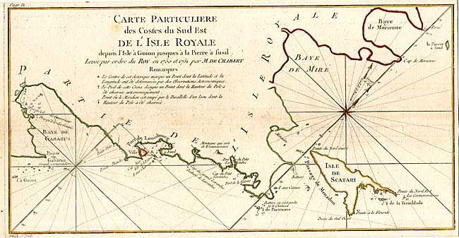
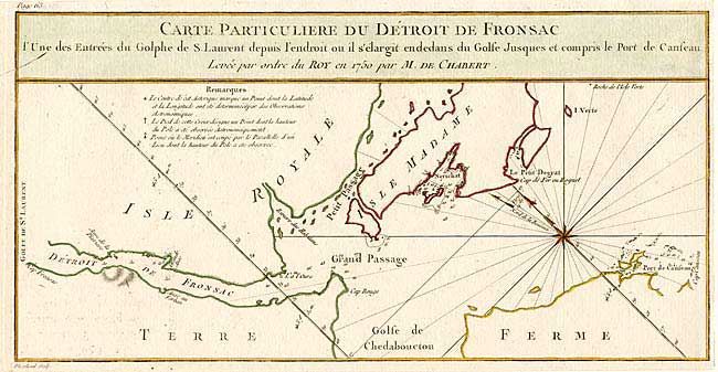
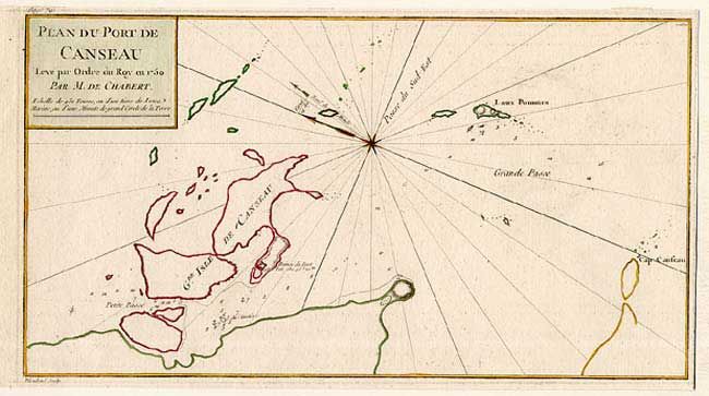
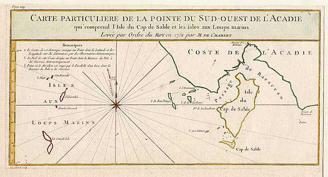
Four attractive small charts of parts of Nova Scotia from this important French voyage of discovery. 1) Carte Particuliere des Costes du Sud Est de l' Isle Royale depuis l' Isle covers part of the coast of present-day Cape Breton Island with Isle de Scatari. The fortifications of Louisbourg are shown along with numerous soundings and anchorages. 2) Carte Particuliere du Detroit de Fronsac is a chart of the mouth of the Fronsac River and Isle Madame. 3) Carte Particuliere de la Pointe du Sud-Ouest de l' Acadie qui comprend l' Isle du Cap de Sable et les Isles aux Loups marins covers the southwestern coast and Cape Sable… 4)Plan du Port de Canseau features Canso (Grassy Island) and locates the ruins of a fort. All are decorated with a compass rose indicating the magnetic variation. Engraved by Dheulland.
References: Kershaw #701.
Condition: A
Clean crisp impressions with original color. Trimmed from a folio sheet containing six small charts by Chabert.