Catalog Archive
Auction 104, Lot 135

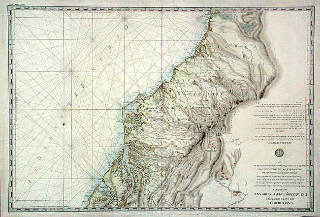
"Carte Reduite des Cotes Orientales de l'Amerique Septentrionale Contenant Partie du Nouveau Jersey, La Pen-sylvanie, le Mary-land, la Virginie, la Caroline Septentrionale, la Caroline Meridionale et la Georgie…", Sartine
Subject: Colonial Mid-Atlantic and Southeast

Period: 1778 (dated)

Publication:

Color: Hand Color

Size:
34.4 x 23.4 inches
87.4 x 59.4 cm
Download High Resolution Image
(or just click on image to launch the Zoom viewer)

A large, handsome and important Revolutionary War chart published by the Depot de la Marine. This chart was available to the French fleet when the focus of the war shifted to the south. It extends from Delaware Bay and Philadelphia south through much of Georgia to Island Amelia and St. Johns River. Good detail along the coast plus much inland information on rivers, cities, mountains and forts. Fleur-de-lis and rhumb lines fill the sea.

References:

Condition: A

Bright impression on thick paper. A couple of very light small stains along centerfold, still very good.

Estimate: $1,800 - $2,200

Sold for: $1,300

Closed on 9/10/2003

Archived