Catalog Archive
Auction 104, Lot 105

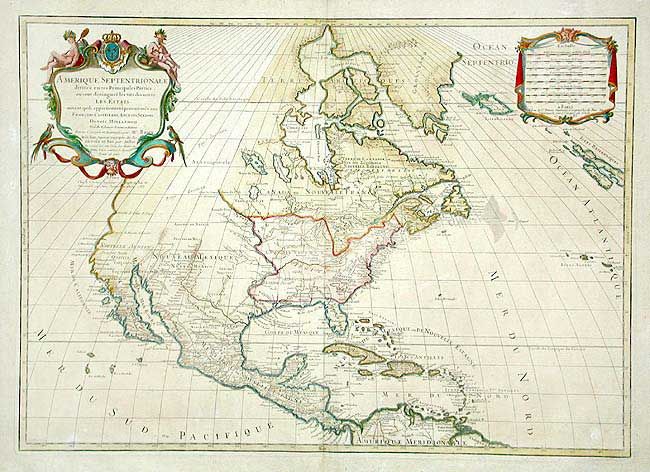
"Amerique Septentrionale Divisee en Ses Principales Parties, ou sont distingues les uns des autres Les Estats…", Brion de la Tour, Louis
Subject: North America

Period: 1783 (dated)

Publication: Atlas General

Color: Hand Color

Size:
25.5 x 18.4 inches
64.8 x 46.7 cm
Download High Resolution Image
(or just click on image to launch the Zoom viewer)

Later issue based on the cartography of Sanson/Jaillot's map. The Northwest is labeled Pays Inconnu, Florida stretches to the Mississippi River and Nouveau Mexique occupies the entire west. The northwestern coast is mostly a straight line above C. Blanco with small indents at the Entrée de Martin d'Aguilar and Entrée Juan de Fuca. A very early map naming the United States, here hastily added offshore. Scores of place names including forts, Indian tribes and much more. Lovely title cartouche with Native Americans and tropical birds at upper left, balanced by the distance scale cartouche on right.

References: Phillips (A) 5998-8.

Condition: B

Nice impression and color with full margins. Two small areas of paper abrasion, both in blank areas.

Estimate: $1,000 - $1,200

Unsold

Closed on 9/10/2003

Archived