Catalog Archive
Auction 103, Lot 432

"Carte Reduite du Golphe de Genes Contenant Partie des Costes de Provence, celles de Piemont de Genes et de Toscane...", Bellin, Jacques Nicolas

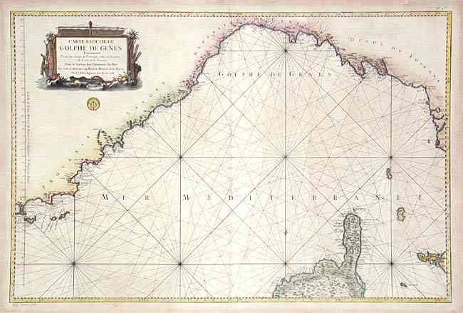
Subject: Mediterranean

Period: 1768 (dated)

Publication: Hydrographie Francoise

Color: Hand Color

Size:
33.6 x 22 inches
85.3 x 55.9 cm
Download High Resolution Image
(or just click on image to launch the Zoom viewer)

Large navigational chart covering the Mediterranean coast from Hyeres (France) to Livorno (Italy), including St. Tropez, Cannes, Nice, Monaco, Genoa, Portofino, la Spezia, Piza and Livourne. Also shows part of Corsica and western Elba. The sea is filled with rhumb lines and a fleur-de-lys. Decorative title cartouche and seal of the Depot de la Marine. Large and handsome chart that covers an important portion of the Mediterranean.

References: Phillips (A) 588.

Condition: B

Dark impression on thick paper with nice color. Scattered light toning and a few marginal tears with old repairs, else very good.

Estimate: $400 - $500

Sold for: $250

Closed on 6/11/2003

Archived