Catalog Archive
Auction 103, Lot 234

"Carte Reduite des Isles de la Guadeloupe Marie Galante et les Saintes Dressee au Depost des Cartes Plans et Journux de la Marine", Bellin, Jacques Nicolas

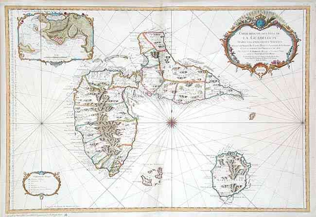
Subject: Lesser Antilles - Guadeloupe

Period: 1759 (dated)

Publication: Hydrographie francoise

Color: Hand Color

Size:
34 x 23 inches
86.4 x 58.4 cm
Download High Resolution Image
(or just click on image to launch the Zoom viewer)

Beautifully engraved large-scale chart of Guadeloupe, Isles de Saintes and Marie Galante (French West Indies). Shows parishes, settlements, forts, windmills, watershed & mountains, anchorages, etc. Handsomely decorated with a large compass rose, numerous rhumb lines, title cartouche surmounted by royal coat of arms, plus decorative borders surrounding the legend and another around the large inset Environs du Port Louis.

References: Phillips (A) 590-78.

Condition: B

Fine impression and coloring on thick paper with large watermark. Scattered foxing or surface soiling. A little toned and discolored along centerfold with slight abrasion of a few words.

Estimate: $800 - $100

Sold for: $500

Closed on 6/11/2003

Archived