Catalog Archive
Auction 103, Lot 230

"Carte de l'Isle de la Barbade dressee au Depost des Cartes et Plans de la Marine", Bellin, Jacques Nicolas
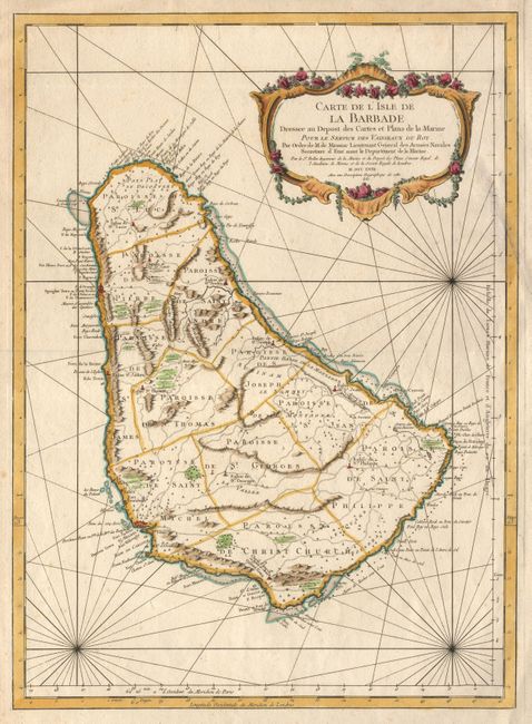
Subject: Barbados

Period: 1758 (dated)

Publication: Hydrographie Francoise…

Color: Hand Color

Size:
15.7 x 21.7 inches
39.9 x 55.1 cm
Download High Resolution Image
(or just click on image to launch the Zoom viewer)

One of the finest large-scale maps of Barbados, shown here divided into parishes. Published by the French Admiralty, the map features bold engraving, elaborate cartouche, rhumb lines, topography, anchorages, shoals, rocks, etc. A very handsome chart of the island.

References:

Condition: B

Crisp impression and good color on fine, thick paper. Some very light spots and well repaired tear into map, else very good.

Estimate: $800 - $1,000

Sold for: $500

Closed on 6/11/2003

Archived