Catalog Archive
Auction 103, Lot 140

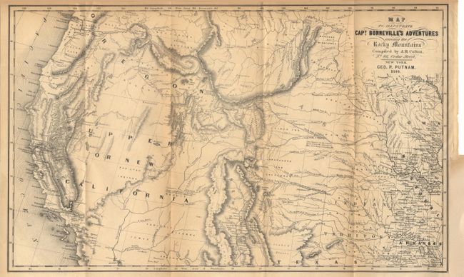
"Map to Illustrate Capt. Bonneville's Adventures among the Rocky Mountains", Putnam/Colton

Subject: Western United States

Period: 1849 (dated)

Publication: Irving's Adventures of Captain Bonneville

Color: Black & White

Size:
18.2 x 11.1 inches
46.2 x 28.2 cm
Download High Resolution Image
(or just click on image to launch the Zoom viewer)

This interesting map is based on Fremont's map of the same period. The region west of the Mississippi to the Pacific Ocean is delineated with the new gold region of California and a notation of Sutter's Fort. The expedition route described is that of Captain Benjamin Bonneville who explored the American West from 1832-1836. The expedition party traveled parallel to the course of the Snake and the Columbia rivers, going as far as Fort Walla Walla before turning back. Fremont's route through California is shown, as well as Kearny's route along the Gila River.

References: Wagner-Camp #67:14.

Condition: B

Folding as issued, light toning along folds. Remargined at binding edge closing tiny tear, just into border.

Estimate: $275 - $325

Sold for: $800

Closed on 6/11/2003

Archived