Catalog Archive
Auction 102, Lot 92

"Nouvelle Carte de l'Amerique Septentrionale dressee sur les plus Nouvelles Observations de Messieurs de l'Academie des Sciences et des Meilleurs Geographes avec des tables tres instructives et curieuses de la division de tous les Etats…", Chatelain, Henry Abraham
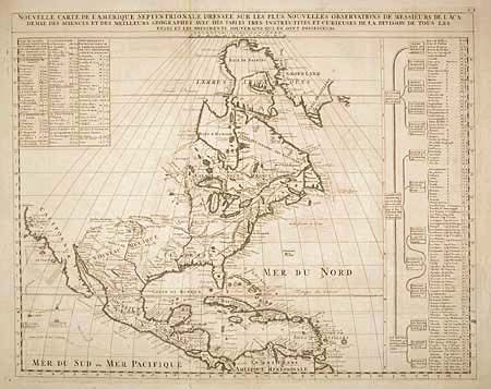
Subject: North America

Period: 1705 (circa)

Publication: Atlas Historique

Color: Black & White

Size:
23.3 x 18.5 inches
59.2 x 47 cm
Download High Resolution Image
(or just click on image to launch the Zoom viewer)

Fine folio map covering the region from northern Venezuela to Baffin Bay with California as an Island. All five of the Great Lakes are present; but Lake Erie is unnamed. The Ohio River is shown, but unnamed. The Pacific Northwest is blank north of Mendocin. Two large tables give a detailed account of the affiliations of the native inhabitants and the colonial authority throughout the area with a location key.

References: Lowery #263; Phillips (A) 579.

Condition: B

Good impression on a fine sheet of hand-laid paper with watermark and full margins. Very tiny hole in Bahamas.

Estimate: $850 - $950

Sold for: $600

Closed on 3/5/2003

Archived