Catalog Archive
Auction 102, Lot 353

"Letts's Geological Map of England & Wales [Together With] England with its Canals and Railways",

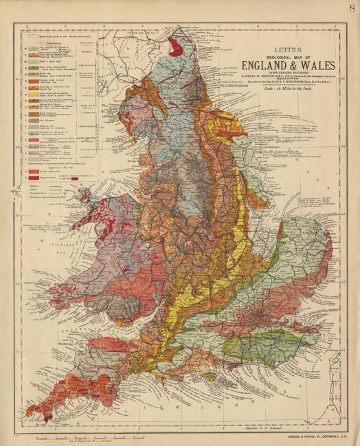
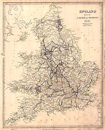
Subject: England & Wales

Period: 1837-90 (circa)

Publication:

Color:

Size:
12.6 x 15.5 inches
32 x 39.4 cm
Download High Resolution Image
(or just click on image to launch the Zoom viewer)

Lot of two maps of England and Wales. First map is Lett's Geological Map of England and Wales, with Leading Railways published circa 1890 by Mason & Payne. This minutely detailed map with railways, geologic formations and deposits is based on Sir R. I. Murchison's map. Printed color. Second map is England with its Canals and Railways, published by the Society for the Diffusion of Useful Knowledge in 1837. This is also a general map of England featuring railways, cities and town. In original outline color.

References:

Condition: A

Letts map fine. SDUK map has a closed tear just touching neatline and some surface soil.

Estimate: $120 - $150

Sold for: $60

Closed on 3/5/2003

Archived