Subject: Canada
Period: 1744 (dated)
Publication: Histoire et Description Generale de la Nouvelle France
Color: Black & White
Size:
11 x 7.7 inches
27.9 x 19.6 cm
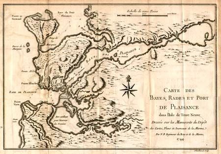
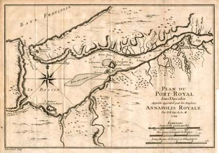
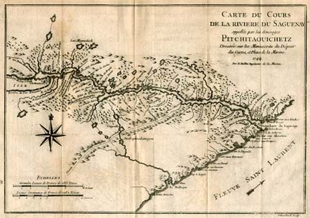
Three fine charts engraved by Dheulland. 1) Carte du Cours de la Riviere du Saguenay appellee par les Sauvages Pitchitaouichetz. Nicely detailed map of part of the province of Quebec. The course of the river is well depicted. The settlements of Tadoussac and Chicoutimi, and the road to Lake Saint Charles are shown. 2) Carte des Bayes, Rades et Port de Plaisance dans l' Isle de Terre Neuve… Chart of Placentia Harbor and Argentia Harbor on the Avalon Peninsula in Newfoundland. The French fort, village, and battery are shown at the harbor entrance. These harbors were used to overwinter fleets and the harbors are so marked. 3) Plan du Port Royal dans l' Accadie Appelle aujour d' par les Anglois Annapolis Royale. Detailed map of the important colonial settlement in Nova Scotia. The map clearly depicts the harbor entrance with soundings, anchorages and navigational hazards. A large compass rose orients the map.
References: 1) Kershaw #1002. 2) Kershaw #519; MCC 96 #698. 3) Kershaw #765; MCC 96 #704.
Condition: B
Binder's trim with a couple small separations of folds in blank margins and minor toning along folds.