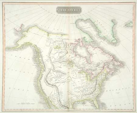
Subject: North America
Period: 1820 (circa)
Publication: Thomson's New General Atlas
Color: Hand Color
Size:
23.7 x 19.5 inches
60.2 x 49.5 cm
Well engraved map of the continent showing the latest discoveries in the western parts of Canada and United States including those of Mackenzie, Hearne, and Lewis & Clark. Includes Mexico only to Monterey. The most prominent feature on the map is the mountains of the Continental Divide labeled Rocky Mountains. Many Indian tribes are named including Snake, Plume, Red, Blue, Wolf, and Beaver. Filled with notations throughout including references to Captain Lewis. The intermountain region is completely blank. A fascinating map that deserves more study.
References: Wheat [TMW] #319; Phillips (A) #731, 751, 3545.
Condition: B
Dark impression and pleasant pastel coloring. Lightly toned along centerfold and close margin at bottom, else very good.