Subject: Western Hemisphere
Period: 1673 (circa)
Publication:
Color: Black & White
Size:
21 x 16.8 inches
53.3 x 42.7 cm
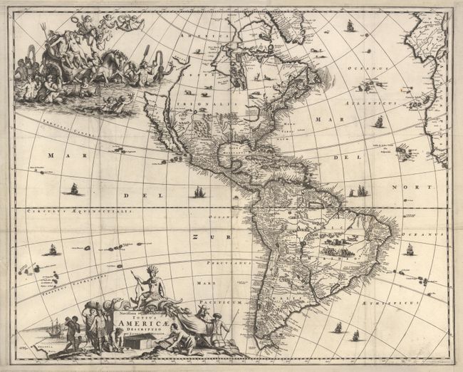
Uncommon and exceptionally decorative map of the Americas based largely on Visscher's map of 1658. California is shown as a large island after Henry Brigg's map with the Pacific coastline continuing northeast toward the Straet Anian, which separates it from Anian. The interior is lacking any of the recent French discoveries and there is one huge, open-ended, Great Lake and a confused system of rivers in the Mississippi valley. In the Southwest, the Rio del Norto flows from a large interior lake, and empties into the sea between the mainland and California. In South America, Parime Lacus is prominent. The most outstanding features of the map are the beautifully engraved decorative details that include numerous vignettes of wildlife, Indian battles, sailing ships and battles, and two large cartouches. At bottom, the title is surrounded by Native Americans trading with Europeans. Filling the North Pacific is a lavish scene of Neptune and his consort in a chariot surrounded by his entourage and putti. A very good example of this map, which normally suffers damage due to be folded into the small format book.
References: McLaughlin #50; Tooley (AM) #36, plt. 43.
Condition: B
Issued folded and now pressed with some minor soiling along folds still visible. Small tear at fold intersection professionally repaired and backed with light Japanese tissue.