Subject: Mexico
Period: 1847
Publication: Sen. Doc. #1, 30th Congress, 1st Session
Color: Black & White
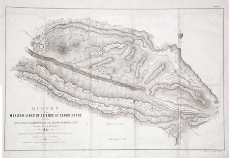
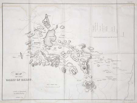
First (19 x 12.3"), surveyed by Major Turnbull and Capt. McLellan, illustrates one of the major battles of the Mexican American War. It shows mountains, roads, Mexican and American camps, gun batteries and the route of Shield's Brigade. Santa Ana had taken up a position at the pass of Cerro Gordo, thinking to halt Gen. Scott's advance on Mexico City. After fierce fighting, the Mexican forces were completely defeated, surrendering 3,000 prisoners (including 5 generals), over 4,000 stands of arms and 43 pieces of artillery. American losses were 64 killed and 353 wounded. Second (16.5 x 12.2") is a plan of the vicinity around Mexico City. Includes the lakes and extends to include Toluca in the west, S. Antonio, Cholnla and Cuatlacingo in the east. Inset profile of the "Route between Mexico and Vera Cruz. Nice pair of Mexican War related maps.
References:
Condition: B
Both have light tide marks at top and bottom, otherwise very good. Folding, as issued.