Catalog Archive
Auction 101, Lot 155

"Route of the Western Rail Road. East of Connecticut River [together with] … West of Connecticut River", Anon.

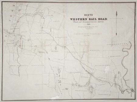
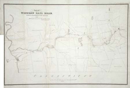
Subject: Connecticut

Period: 1837 (dated)

Publication: Reports of the Engineers of the Western Rail Road Corporation,

Color: Black & White

Size:
See Description
Download High Resolution Image
(or just click on image to launch the Zoom viewer)

Pair of maps featuring the railroad and showing counties and towns along the route from Worcester to West Stockbridge. Lithographed by Thomas Moore. East map (25.5 x 16.5"), West map (25.5 x 18.5"). Together with disbound report "Reports of the Engineers of the Western Rail Road Corporation made to the Directors, in 1836-37 (120 pp.) Printed on thin banknote paper.

References: Sabin #103009.

Condition: B

Binder's trim nearly to neatline on Eastern sheet with short binding tear repaired with Japanese tissue. Some stains toned with pastel.

Estimate: $275 - $325

Sold for: $200

Closed on 12/4/2002

Archived