Catalog Archive
Auction 100, Lot 348

"Carte Nouvelle de la Pologne, Avant son demenbrement dirigee par Mr. Philippe…", Philippe De Pretot, Etienne Andre
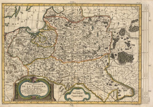
Subject: Poland

Period: 1787 (published)

Publication: Atlas Universel…

Color: Hand Color

Size:
14.7 x 10.5 inches
37.3 x 26.7 cm
Download High Resolution Image
(or just click on image to launch the Zoom viewer)

Attractive copper engraved map showing Poland just prior to her demise at the hands of Prussia and Austria. The kingdom is divided into five regions; Pomerania, Prussia, Livonia, Lithuania and Poland. Includes good detail of mountains, rivers, lakes, forests, cities and villages. Decorative title and scale of miles cartouches.

References:

Condition: B

Very faint damp stains at bottom with slight cockling, else very good.

Estimate: $190 - $220

Sold for: $140

Closed on 9/12/2002

Archived