Catalog Archive
Auction 100, Lot 345

"Plan de Paris en 1864 Divise en 20 Arrondissements", Bez and Dubreuil

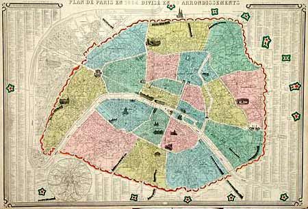
Subject: France, Paris

Period: 1864 (dated)

Publication:

Color: Hand Color

Size:
33.8 x 23 inches
85.9 x 58.4 cm
Download High Resolution Image
(or just click on image to launch the Zoom viewer)

Scarce and delightful map of the heart of the city. The map is filled with vignettes of major buildings and the railroads are graphically depicted with vignettes of trains. Key to the streets and fifteen fortresses surround the map. Inset of Paris and vicinity. The large map is enclosed in a bold keyboard style border.

References:

Condition: A

Margins a bit rough with some short tears repaired with archival tape, map very good

Estimate: $400 - $450

Sold for: $325

Closed on 9/12/2002

Archived