Catalog Archive
Auction 100, Lot 158

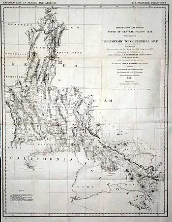
"Explorations and Surveys South of Central Pacific R. R. War Department Preliminary Topographical Map Embracing in skeleton a portion only of the Notes from Surveys…", Wheeler, George (Lt)

Subject: United States - Western

Period: 1871 (dated)

Publication: Sen. Doc 65, 45th Cong. 2nd Sess.

Color: Black & White

Size:
22 x 28 inches
55.9 x 71.1 cm
Download High Resolution Image
(or just click on image to launch the Zoom viewer)

This map was the result of Wheeler's spectacular exploration of 1871. The sudden emergence of the Interior Department's civilian surveys posed a major threat to military mapping and exploration efforts. Wheeler, barely 30 years of age, was tasked to gather information and produce a highly accurate map of the area. This he accomplished and in so doing conceived of the U.S. Geographical Surveys West of the One Hundredth Meridian of which this map is the forerunner. Very detailed with scores of mining districts located and named. Wheat refers to it as a "map of great interest." The map displays a portion of Nevada together with parts of California, Utah and Arizona, as bounded by Tucson, San Bernardino and the Sierra Nevadas, St. George, and north to Mountain City, above Elko.

References: Wheat [TMW] 1237.

Condition: A

Clean and bright. Issued folding, now pressed flat.

Estimate: $150 - $250

Sold for: $150

Closed on 9/12/2002

Archived