Catalog Archive
Auction 100, Lot 135

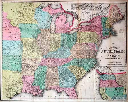
"Map of the United States of America, Showing the Rail Roads To Illustrate Harpers Gazetteer", Smith, J. Calvin
Subject: United States

Period: 1855 (dated)

Publication: Harpers Gazetteer

Color: Hand Color

Size:
27 x 21 inches
68.6 x 53.3 cm
Download High Resolution Image
(or just click on image to launch the Zoom viewer)

A large inset shows the boundaries of Washington and Oregon extended to the Rocky Mountains. Utah includes Nevada and part of Colorado. New Mexico includes Arizona. An extended Nebraska includes the rest of the West. The Indian Territory is here called Western Territory. An inset at top depicts railroad and canal routes from Albany to Buffalo. A table of explanations identifies markings for State Capitals, towns, villages, railroads, canals and stage roads. A remarkable map in full original color.

References:

Condition: A

Backed with archival tissue, binding side margin reinforced with paper and a little toning along one fold, still very good.

Estimate: $300 - $400

Sold for: $300

Closed on 9/12/2002

Archived