Showing Featured Lots(remove filter)
Filtered by Category:Europe & Mediterranean(Show All Categories)
Showing results for:Auction 189
Catalog Archive
10 lots
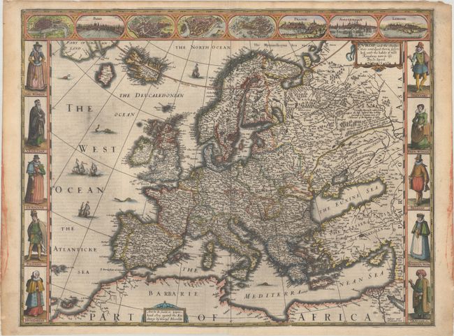
Auction 189, Lot 359
Subject: Europe
Speed, John
Europ, and the Cheife Cities Contayned Therin Described; with the Habits of Most Kingdoms Now in Use, 1626
Size: 20 x 15.4 inches (50.8 x 39.1 cm)
Estimate: $3,000 - $3,750
Speed's Carte-a-Figures Map of Modern Europe
Sold for: $2,200
Closed on 9/14/2022
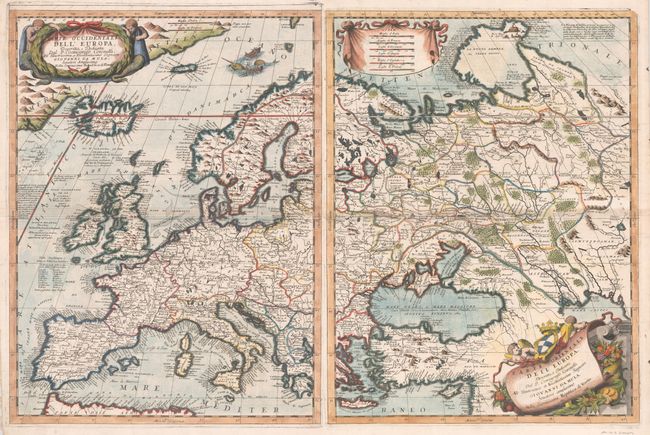
Auction 189, Lot 363
Subject: Europe
Coronelli, Vincenzo Maria
[Lot of 2] Parte Occidentale dell' Europa... [and] Parte Orientale dell' Europa..., 1697
Size: 18.1 x 24.3 inches (46 x 61.7 cm)
Estimate: $2,200 - $2,500
Decorative Two-Sheet Map of Europe
Sold for: $1,600
Closed on 9/14/2022
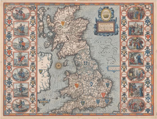
Auction 189, Lot 369
Subject: Britain
Speed, John
Britain as It Was Devided in the Tyme of the Englishe-Saxons Especially During Their Heptarchy, 1616
Size: 20.2 x 15.1 inches (51.3 x 38.4 cm)
Estimate: $3,000 - $3,750
Early Example of Speed's "Heptarchy" Map Depicting the Saxon Kingdoms
Sold for: $3,000
Closed on 9/14/2022
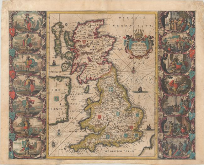
Auction 189, Lot 370
Subject: Britain
Jansson, Jan
Britannia Prout Divisa Suit Temporibus Anglo-Saxonum, Praesertim Durante Illorum Heptarchia, 1646
Size: 20.6 x 16.6 inches (52.3 x 42.2 cm)
Estimate: $1,200 - $1,500
Jansson's Splendid Heptarchy Map in Full Contemporary Color
Unsold
Closed on 9/14/2022
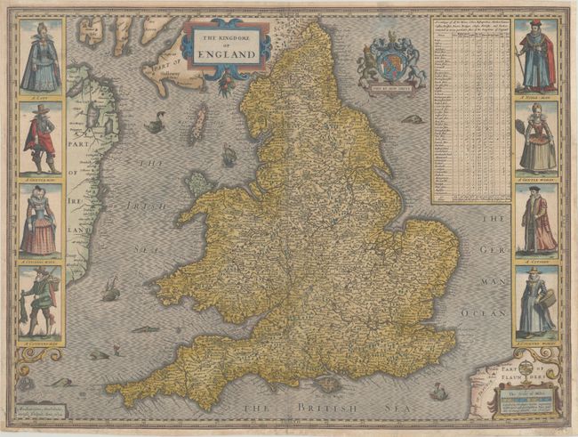
Auction 189, Lot 387
Subject: England & Wales
Speed, John
The Kingdome of England, 1632
Size: 20.3 x 15.2 inches (51.6 x 38.6 cm)
Estimate: $1,500 - $1,800
Speed's Carte-a-Figures Map of England and Wales
Sold for: $1,000
Closed on 9/14/2022
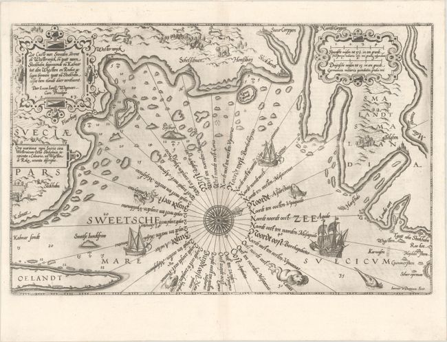
Auction 189, Lot 407
Subject: Southeastern Sweden
Waghenaer, Lucas Jansz
Zee Custe van Sweeden, Otrent de Westerwijck en Tgatt vann Stockholm, Beginnende va Kalmar..., 1585
Size: 20.1 x 12.9 inches (51.1 x 32.8 cm)
Estimate: $1,400 - $1,700
Uncommon and Early Sea Chart of Southeastern Sweden
Sold for: $1,000
Closed on 9/14/2022
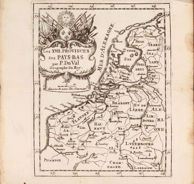
Auction 189, Lot 429
Subject: Low Countries, Atlases
Duval, Pierre
[Two Atlases in One Book] Cartes et Tables de Geographie, des Provinces Eschues a la Reine Tres-Chretiene [and] Les XII. Provinces. Ou sont les Conquestes du Roy en Holande, et en Flandres, 1672
Size: 3.6 x 6 inches (9.1 x 15.2 cm)
Estimate: $1,200 - $1,500
Two Miniature Atlases of Louis XIV's Attempts to Conquer the Spanish Netherlands
Sold for: $900
Closed on 9/14/2022
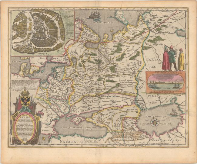
Auction 189, Lot 504
Subject: Russia in Europe
Blaeu, Willem
Tabula Russiae ex Autographo, quod Delineandum Curavit Foedor Filius Tzaris Boris Desumta ... M.DC.XIIII, 1643
Size: 21.4 x 16.7 inches (54.4 x 42.4 cm)
Estimate: $1,800 - $2,100
Blaeu's Decorative Map of Russia
Sold for: $1,300
Closed on 9/14/2022
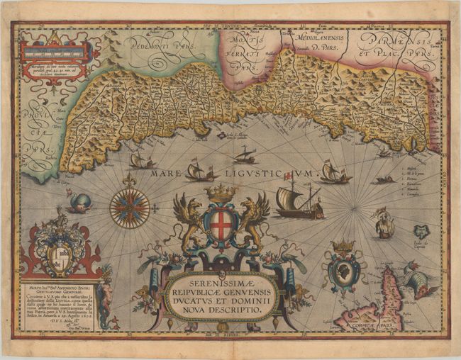
Auction 189, Lot 524
Subject: Northwestern Italy
Ortelius, Abraham
Serenissimae Reipublicae Genuensis Ducatus et Dominii Nova Descriptio, 1608
Size: 21.3 x 15.4 inches (54.1 x 39.1 cm)
Estimate: $4,000 - $4,750
One of the Rarest Maps Published in Ortelius' "Theatrum"
Unsold
Closed on 9/14/2022
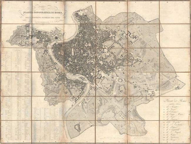
Auction 189, Lot 530
Subject: Rome, Italy
Pianta Topografica di Roma Dalla Direzione Generale del Censo, 1829
Size: 63.1 x 47.1 inches (160.3 x 119.6 cm)
Estimate: $2,000 - $2,300
Rare, Wall-Sized Bird's-Eye Plan of Rome
Sold for: $1,500
Closed on 9/14/2022
10 lots