Showing Featured Lots(remove filter)
Filtered by Category:Canada(Show All Categories)
Showing results for:Auction 203
Catalog Archive
4 lots
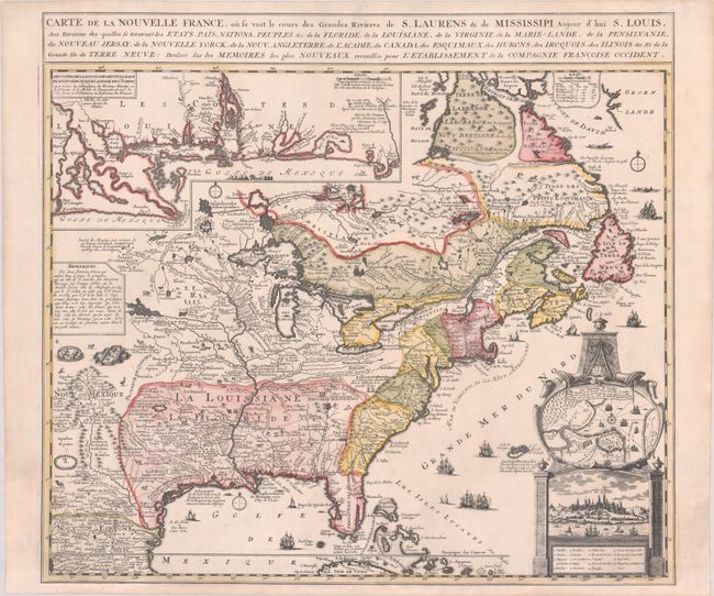
Auction 203, Lot 86
Subject: Colonial Eastern United States & Canada
Fer, Nicolas de
Carte de la Nouvelle France, ou se Voit le Cours des Grandes Rivieres de S. Laurens & de Mississipi Aujour d'hui S. Louis, aux Environs des-quelles se Trouvent les Etats, Pais, Nations, Peuples, &c. de la Floride, de la Louisiane, de la Virginie..., 1720
Size: 21.9 x 19.8 inches (55.6 x 50.3 cm)
Estimate: $2,750 - $3,500
Striking Map of French Colonial Possessions
Sold for: $2,200
Closed on 4/23/2025
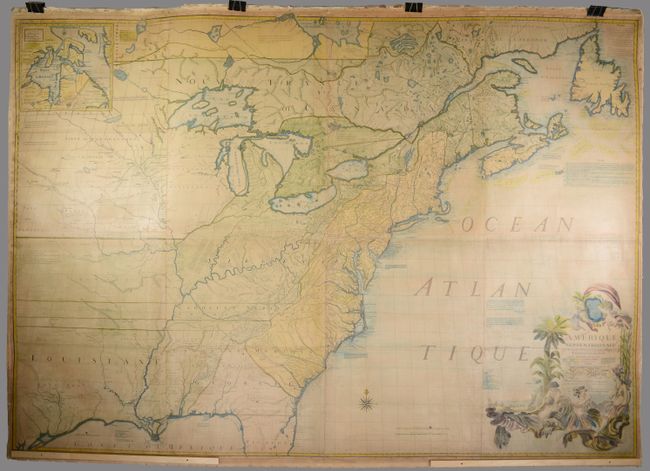
Auction 203, Lot 89
Subject: Colonial Eastern United States & Canada
Mitchell/Le Rouge
Amerique Septentrionale avec les Routes, Distances en Miles, Villages et Etablissements Francois et Anglois par le Docteur Mitchel, 1777
Size: 75 x 52.4 inches (190.5 x 133.1 cm)
Estimate: $9,500 - $12,000
Third French Edition of Mitchell's Monumental Map
Sold for: $5,000
Closed on 4/23/2025
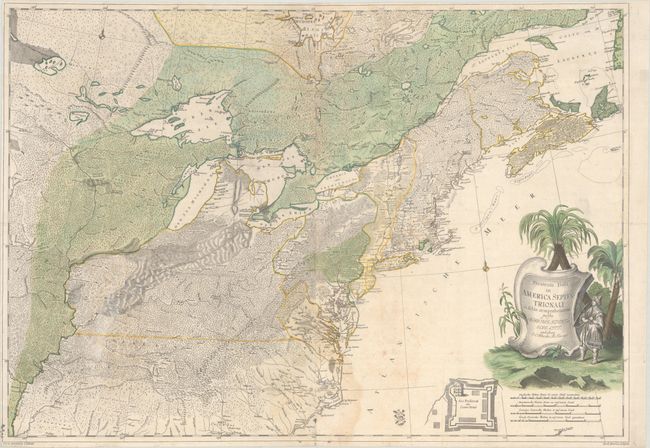
Auction 203, Lot 95
Subject: Colonial Northeastern United States & Canada
Rhode, Johann Cristoph
Theatrum Belli in America Septentrionali II. Foiliis Comprehensum..., 1755
Size: 31.5 x 22 inches (80 x 55.9 cm)
Estimate: $8,000 - $9,500
Scarce German Map Illustrating the French & Indian War
Sold for: $5,000
Closed on 4/23/2025
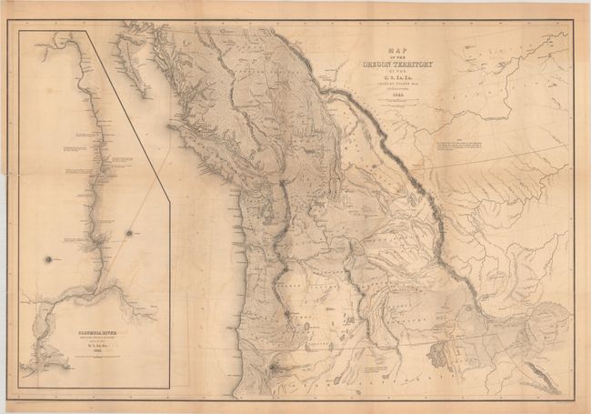
Auction 203, Lot 103
Subject: Northwestern United States & Canada
Wilkes, Charles
Map of the Oregon Territory by the U.S. Ex. Ex., 1841
Size: 34.1 x 22.9 inches (86.6 x 58.2 cm)
Estimate: $1,400 - $1,700
One of the Most Detailed and Important 19th-Century Maps of the American Northwest
Sold for: $1,100
Closed on 4/23/2025
4 lots