Showing Featured Lots(remove filter)
Filtered by Category:Canada(Show All Categories)
Showing results for:Auction 174
Catalog Archive
4 lots
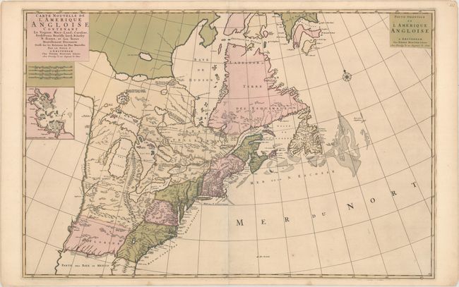
Auction 174, Lot 111
Subject: Colonial Eastern United States & Canada
Mortier, Pierre
Carte Nouvelle de l'Amerique Angloise Contenant la Virginie, Mary-Land, Caroline, Pensylvania Nouvelle Iorck. N: Iarsey N: France, et les Terres Nouvellement Decouerte..., 1700
Size: 35.9 x 23.5 inches (91.2 x 59.7 cm)
Estimate: $2,200 - $2,500
A Map Showing Fascinating Geographic Misconceptions in Colonial America
Sold for: $1,200
Closed on 9/11/2019
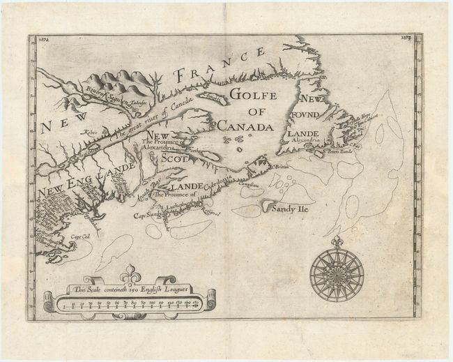
Auction 174, Lot 114
Subject: Colonial Northeastern United States & Canada
Alexander, William (Sir)
[Untitled - Northeastern United States & Canada], 1625
Size: 13.5 x 9.8 inches (34.3 x 24.9 cm)
Estimate: $5,500 - $7,000
The First Map to Name New Scotland
Sold for: $4,000
Closed on 9/11/2019
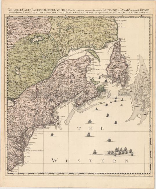
Auction 174, Lot 115
Subject: Colonial Northeastern United States & Canada
Popple/Covens & Mortier
Nouvelle Carte Particuliere de l'Amerique ou sont Exactement Marquees la Nouvelle Bretagne, le Canada ou Nouvelle France, la Nouvelle Ecosse, la Nouvelle Angleterre, la Nouvelle York, la Pensilvanie, Mary-Land, la Caroline Septentrionale..., 1741
Size: 20.7 x 22.5 inches (52.6 x 57.2 cm)
Estimate: $2,200 - $2,500
The Northeastern Sheet of the Reduced-Size Edition of Popple's Map
Sold for: $1,600
Closed on 9/11/2019
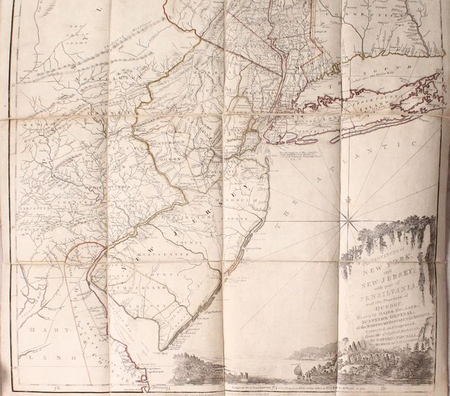
Auction 174, Lot 116
Subject: Colonial Northeastern United States & Quebec
Holland/Pownal
The Provinces of New York, and New Jersey; with Part of Pensilvania, and the Province of Quebec..., 1776
Size: 21.5 x 53.3 inches (54.6 x 135.4 cm)
Estimate: $4,000 - $4,750
Thomas Jefferys' Important Revolutionary War Period Map
Sold for: $2,500
Closed on 9/11/2019
4 lots