Showing Featured Lots(remove filter)
Filtered by Category:Canada(Show All Categories)
Showing results for:Auction 162
Catalog Archive
4 lots
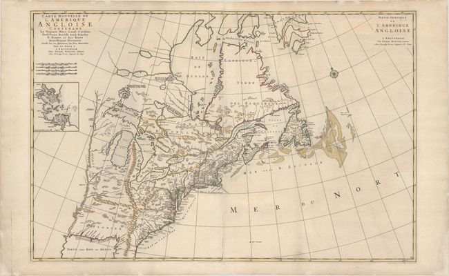
Auction 162, Lot 117
Subject: Colonial Eastern United States & Canada
Mortier, Pierre
Carte Nouvelle de l'Amerique Angloise Contenant la Virginie, Mary-Land, Caroline, Pensylvania Nouvelle Iorck, N: Iarsey N: France, et les Terres Nouvellement Decouerte..., 1700
Size: 35.9 x 23.4 inches (91.2 x 59.4 cm)
Estimate: $2,000 - $2,300
A Map Showing Fascinating Geographic Misconceptions
Sold for: $1,500
Closed on 4/26/2017
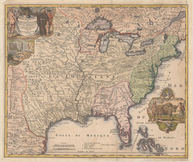
Auction 162, Lot 118
Subject: Colonial Eastern United States & Canada
Homann, Johann Baptist
Amplissimae Regionis Mississipi seu Provinciae Ludovicianae..., 1720
Size: 22.8 x 19.1 inches (57.9 x 48.5 cm)
Estimate: $2,000 - $2,300
Striking Map of Colonial America with Buffalo Vignette
Sold for: $1,300
Closed on 4/26/2017
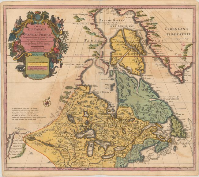
Auction 162, Lot 119
Subject: Colonial Eastern United States & Canada, Great Lakes
Delisle/Covens & Mortier
Carte du Canada ou de la Nouvelle France et des Decouvertes qui y ont ete Faites Dressee sur Plusieurs Observations et sur un Grand Nombre de Relations Imprimees ou Manuscrites, 1730
Size: 22.3 x 19.3 inches (56.6 x 49 cm)
Estimate: $900 - $1,100
One of the Most Influential Maps of Canada, the Great Lakes and Upper Midwest
Sold for: $650
Closed on 4/26/2017
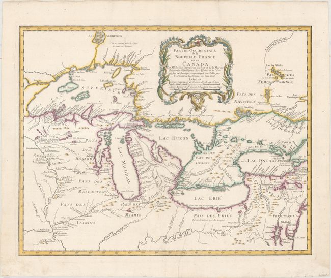
Auction 162, Lot 130
Subject: Colonial Great Lakes
Bellin/Homann Heirs
Partie Occidentale de la Nouvelle France ou du Canada par Mr. Bellin..., 1755
Size: 21.5 x 17 inches (54.6 x 43.2 cm)
Estimate: $1,800 - $2,100
Influential Map of the Great Lakes
Sold for: $975
Closed on 4/26/2017
4 lots