Showing Featured Lots(remove filter)
Filtered by Category:Canada(Show All Categories)
Showing results for:Auction 127
Catalog Archive
4 lots
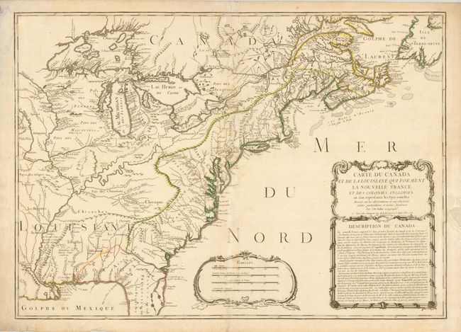
Auction 127, Lot 129
Subject: Colonial United States and Canada
Nolin, Jean Batiste
Carte du Canada et de la Louisiane qui Forment la Nouvelle France et des Colonies Angloises…, 1756
Size: 28 x 19.8 inches (71.1 x 50.3 cm)
Estimate: $2,400 - $3,000
Unsold
Closed on 2/25/2009
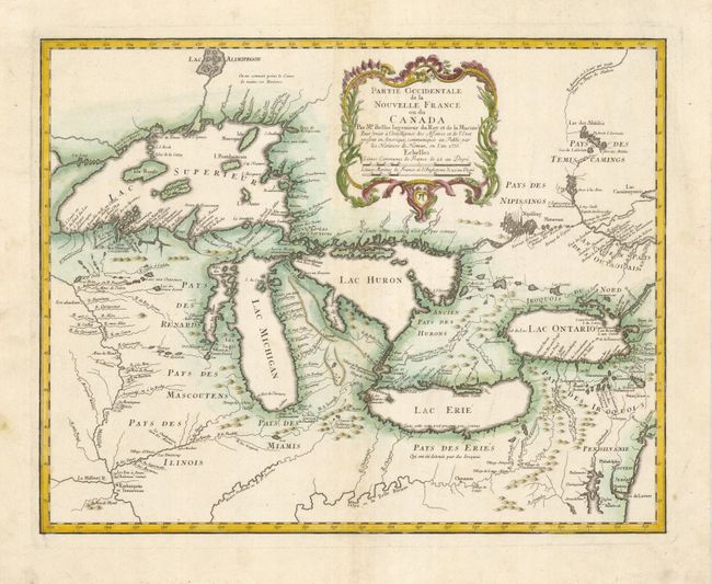
Auction 127, Lot 130
Subject: Great Lakes
Bellin/Homann Heirs
Partie Occidentale de la Nouvelle France ou du Canada, 1755
Size: 21.3 x 16.9 inches (54.1 x 42.9 cm)
Estimate: $2,100 - $2,400
Unsold
Closed on 2/25/2009
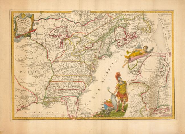
Auction 127, Lot 134
Subject: Colonial United States and Canada
Beaurain, Jean Chev. De
Carte de l'Amerique Septle. Pour servir a l'Intelligence de la Guerre entre les Anglois et les Insurgents, 1777
Size: 24.3 x 16.3 inches (61.7 x 41.4 cm)
Estimate: $7,000 - $10,000
Sold for: $5,000
Closed on 2/25/2009
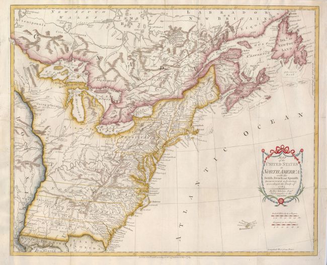
Auction 127, Lot 137
Subject: Eastern United States and Canada
Kitchin, Thomas
Map of the United States in North America: with the British, French and Spanish Dominions adjoining, according to the Treaty of 1783, 1783
Size: 20 x 16 inches (50.8 x 40.6 cm)
Estimate: $1,100 - $1,500
Sold for: $800
Closed on 2/25/2009
4 lots