A Cataloger's Perspective: Mapping Europeby Eliane Dotson
This month, we continue our tour of the world and continents with Europe. (As a reminder, you can view the previous articles in our newsletter archive.) Unlike the other continents of the world, Europe was already well mapped by the time printed maps began to appear on the market. Even though not every region was depicted precisely on maps, there were no new lands to be discovered in Europe. There were certainly advances in cartography over the centuries that would improve the geographical representation of each country, but the overall size and shape of the continent, as well as the relative location of rivers and mountains were fairly well known even in the 15th century.
Beyond documenting your home country, tracing your family's ancestry, or commemorating a favorite vacation spot, what attracts collectors to maps of Europe? While you may not find many mythical islands or imaginary lakes in Europe, there are plenty of cartographic curiosities and artistic masterpieces to collect. Observing how the continent, its countries and cities are portrayed is what makes the continent of Europe so fascinating to cartophiles.
Political Boundaries Europe is no stranger to war, and with war comes the shifting of political boundaries. The Eighty Years' War, Thirty Years' War, War of Spanish Succession, Napoleonic Wars, Crimean War, WWI, WWII, and many others can be traced on maps of Europe over the last five centuries. Following the changes in a country's boundaries over time can illuminate an often complicated political landscape. The strength of a country's military, its alliances, and its political power in Europe determined the country's ability to protect its boundaries from foreign invasions. A nation that successfully extended its boundaries into adjacent territories demonstrated its imperialistic tendencies. Although the overall shape of Europe did not alter much after the establishment of printed maps, the shapes of individual countries and empires were constantly in flux.
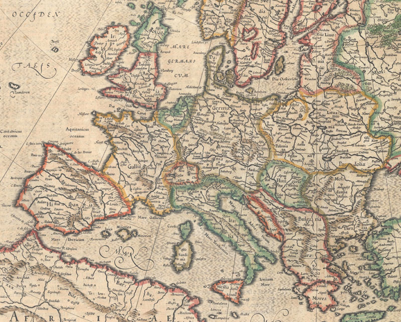
Published during the 80 Years' War, Portugal is shown in union with Spain, and Germany encompasses Denmark. Mercator/Hondius, Europa, ad Magnae Europae, 1619.
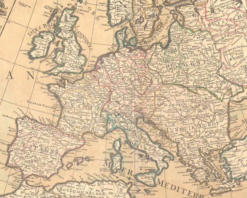
Just before the War of Spanish Succession, central and Eastern Europe are dominated by Germany, Poland, Hungary, and the Turkish Empire. Guillaume Delisle, L'Europe Dressee sur les Observations..., 1700.
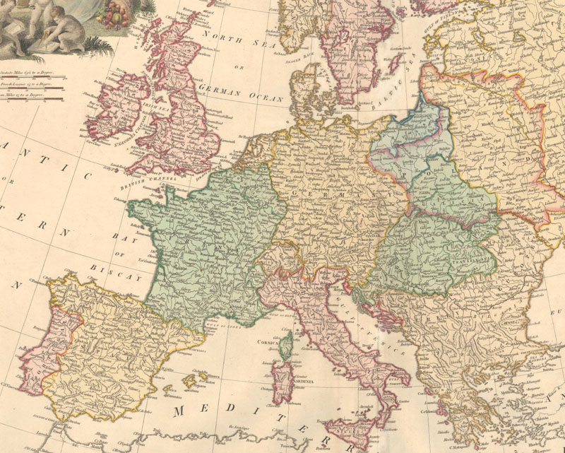
Prior to the outbreak of the French Revolution, the German Empire extends to Italy, the Hungarian Empire encompasses Austria, and France includes Belgium. William Faden, Europe, Exhibiting its Principal States, &c., 1791.
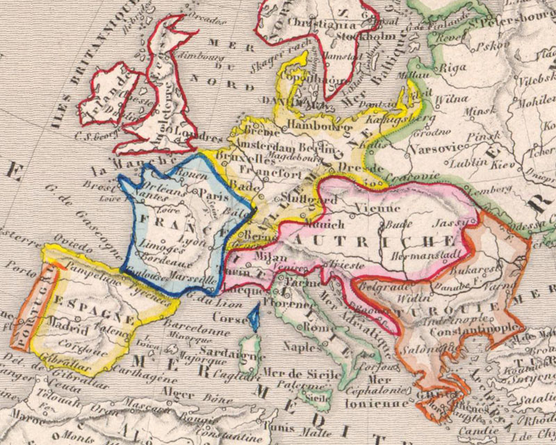
By the mid-19th century, the Austrian Empire extends west, the German Empire extends east, and the Russian Empire overtakes most of eastern Europe. Victor Levasseur, Europe, 1850.
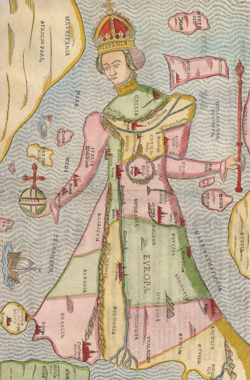
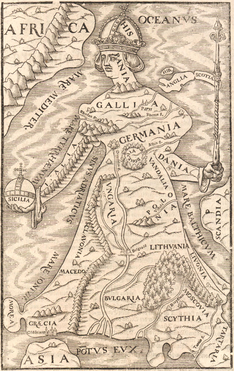
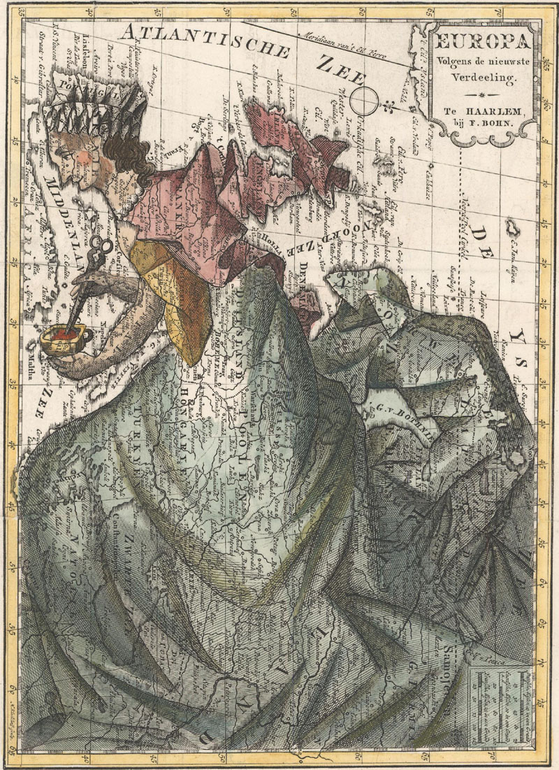
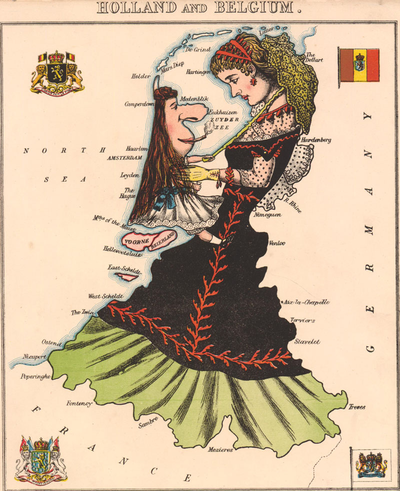
Europe as a Woman One of the more fascinating early cartographic curiosities is the continent of Europe in the form of a woman. The first of these maps was published by Johann Putsch in 1537 and depicted Europe as a regal queen. The idea quickly caught on and was reimagined numerous times in the next few centuries. Although typically portrayed as a queen, Francois Bohn published an anti-Napoleonic version in 1794 in which Europe appeared as a homely middle-aged housewife. Around the same time, caricature maps of individual European countries in the shape of women and men began to appear. These satiric maps continued through the 19th century, depicting countries in an amusing and often unflattering manner.
Europe as Queen of the World. Heinrich Bunting, Europa Prima Pars Terrae in Forma Virginis, 1582.
Another version of Europe as Queen of the World. Sebastian Munster, [Europa Regina], 1580.
An anti-Napoleonic image depicting Europe as a homely middle-aged housewife. Francois Bohn, Europa Volgens de Nieuwste Verdeeling, 1794.
A satirical map showing "Dame Holland" holding "Master Belgium" (sporting a long dress and a cigar) in her arms. Aleph, Holland and Belgium, 1869.
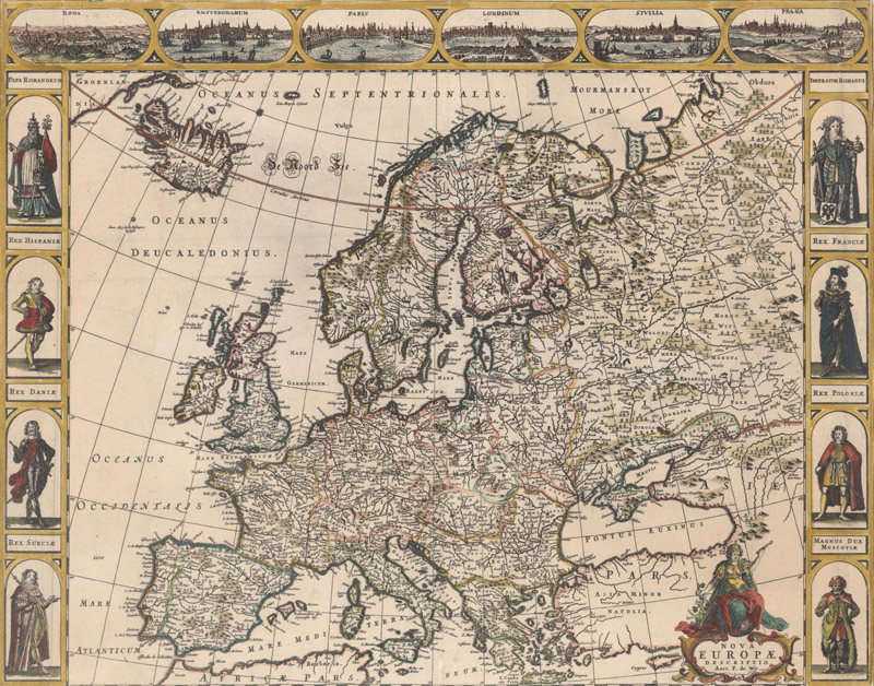
Carte-a-Figures Some of the most sought-after maps of the world and continents are those that feature costumed figures in their borders, known by the French term "carte-a-figures." Many of these maps also incorporate views or plans of important cities on the map. These maps are prized for both their historical and artistic significance, relaying information about geography, culture, and society. Carte-a-figures of individual countries or regions are much less common than those of the world and continents, and more of these maps exist of European countries than of any other continent. John Speed was the first to create a series of carte-a-figures of European countries for his A Prospect of the Most Famous Parts of the World, first published in 1627. The firm of Johannes Jansson and Henricus Hondius incorporated 10 carte-a-figures of European countries and regions in their Atlantis Maioris Appendix in 1630. Although Speed's atlas was republished five times over nearly 50 years, most of the carte-a-figures in the Atlantis Maioris Appendix only appeared in one or two editions, and are therefore exceedingly rare.
Frederick de Wit, Nova Europae Descriptio, 1660.
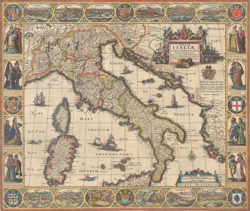
Hondius/Jansson, Tabulae Italiae, Corsicae, Sardiniae, et Adjacentium Regnorum..., 1659.
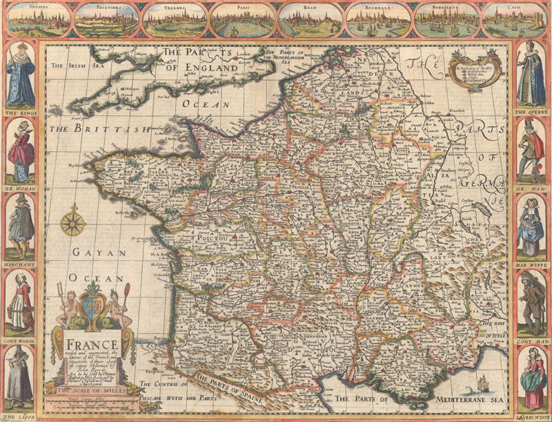
John Speed, France, Revised and Augmented, the Attires of the French and Situations of their Chieftest Cityes Observed, 1676.
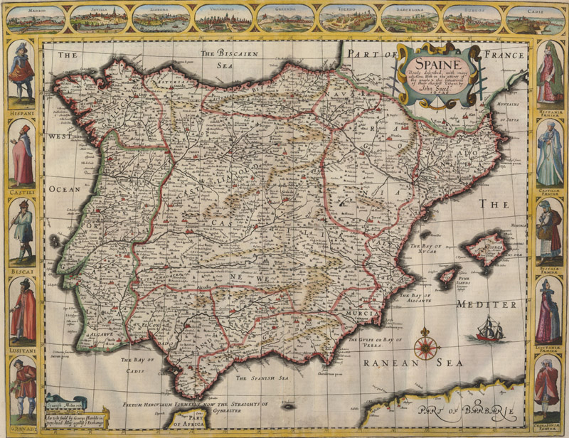
John Speed, Spaine Newly Described, with Many Additions, both in the Attires of the People & the Setuations of their Chiefest Cityes, 1626.
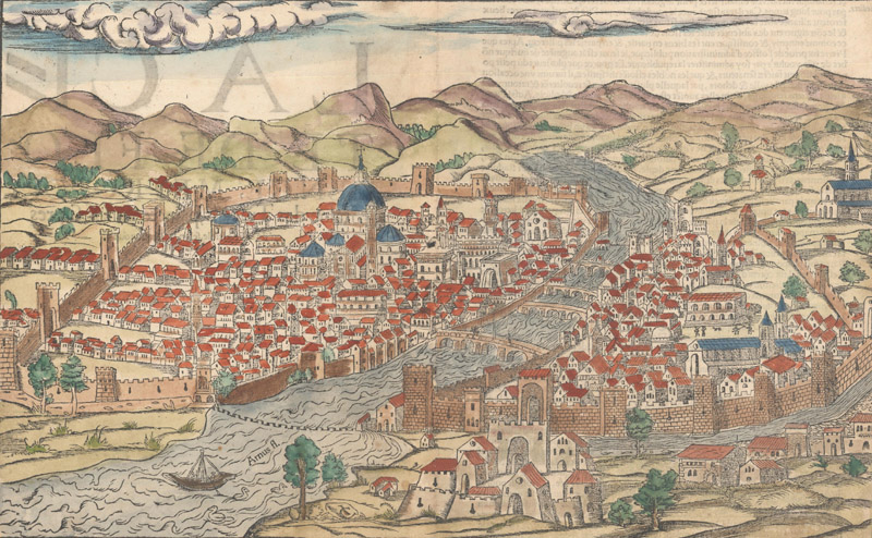
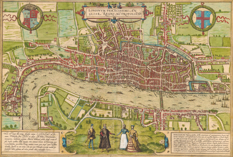
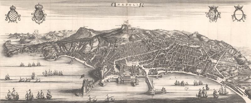
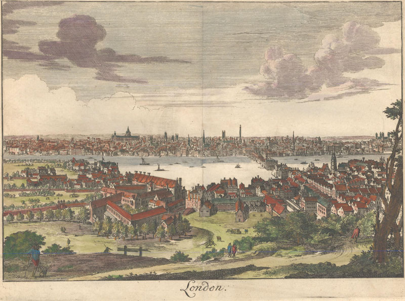
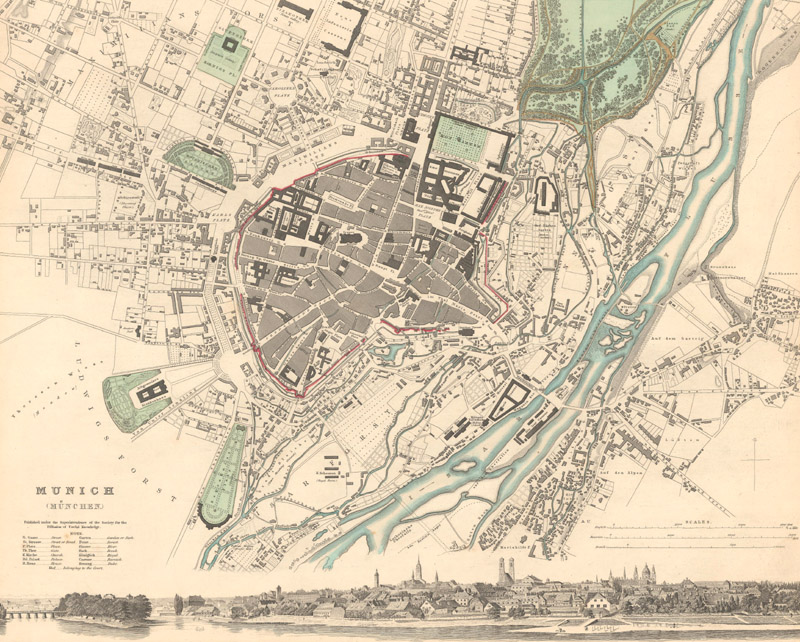
City Views & Plans Another category of maps that demonstrates the artistry of mapmakers is city views and plans. Here again, Europe leads the continents with the number and diversity of city views that are available to collect. Some of the earliest collectible views were published in Sebastian Munster's Cosmographia in numerous editions between 1544-1628. Beginning in 1572, Georg Braun and Franz Hogenberg's popular town book, Civitates Orbis Terrarum, included hundreds of European cities, which remain today as some of the most sought-after city views. Many cartographers copied Braun and Hogenberg's engravings, and others expanded on the idea to create multi-sheet panoramic views of celebrated cities. Bird's-eye plans remained popular through the 19th century, particularly as Europeans began to travel more extensively throughout the continent.
Sebastian Munster, Florence Tresnoble Cite des Tuscans, 1552.
Braun & Hogenberg, Londinum Feracissimi Angliae Regni Metropolis, 1572.
Blaeu/Mortier, Napoli, 1704.
Francois Halma, London, 1705.
SDUK, Munich (Munchen), 1832.
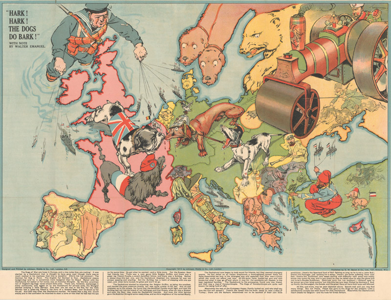
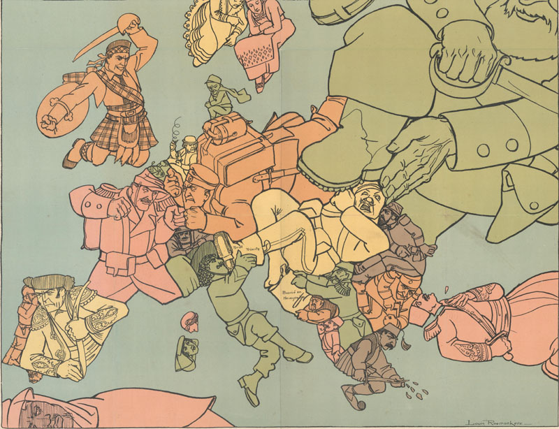
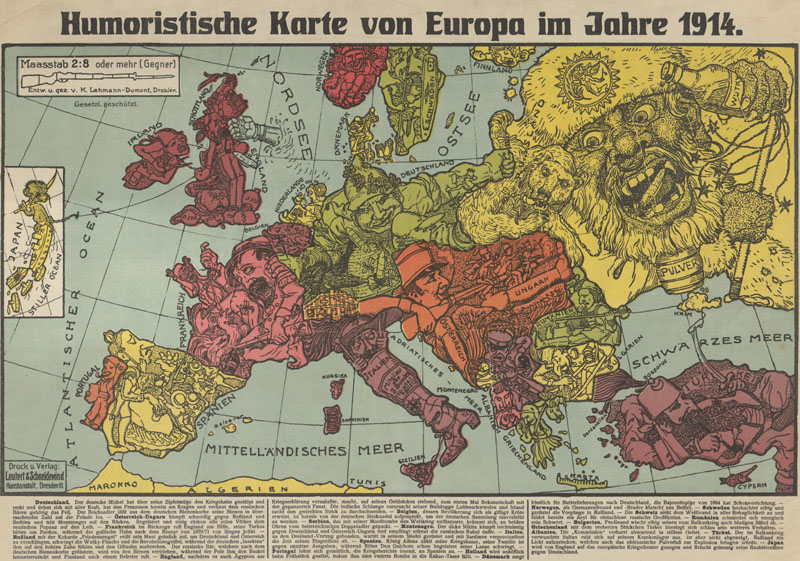
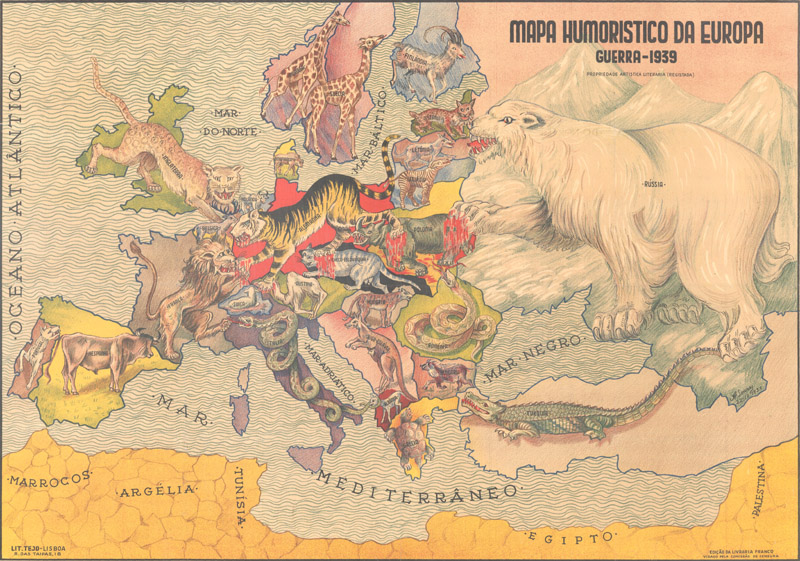
Persuasive Maps Persuasive maps are one of the fastest growing categories within the collectible map market. These maps are characterized by their primary focus of influencing opinions rather than imparting geographical information. The popularity of these maps exploded in Europe during WWI, when various countries were attempting to convince their citizens of the importance of their cause, the strength of their military, the steadfastness of their alliances, and the transgressions of their enemies. Many of these political propaganda maps depict individual countries in Europe as animals or humans designed to match that country's personality and role in the war. As these maps were typically separately issued and ephemeral in nature, they are scarce.
A British perspective at the outbreak of WWI. G. W. Bacon & Company, Hark! Hark! The Dogs Do Bark!, 1914.
An anti-German propaganda map created by a Dutchman during WWI. Louis Raemaekers, Het Gekkenhuis (Oud Liedje, Nieuwe Wijs), 1915.
A German view of the alliance situation and territorial issues at the beginning of WWI. Karl Lehmann-Dumont, Humoristische Karte von Europa, 1914.
A Portuguese zoomorphic map published at the outset of WWII. Antonio Soares, Mapa Humoristico da Europa Guerra, 1939.
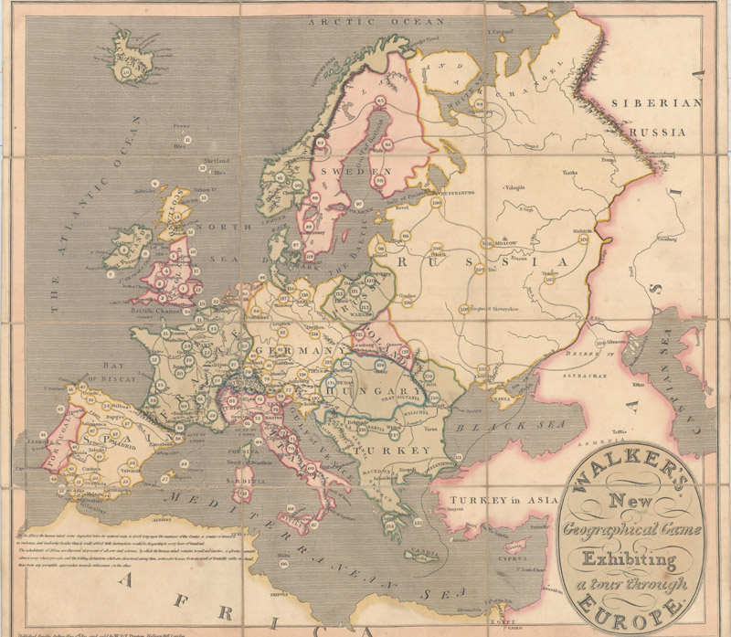
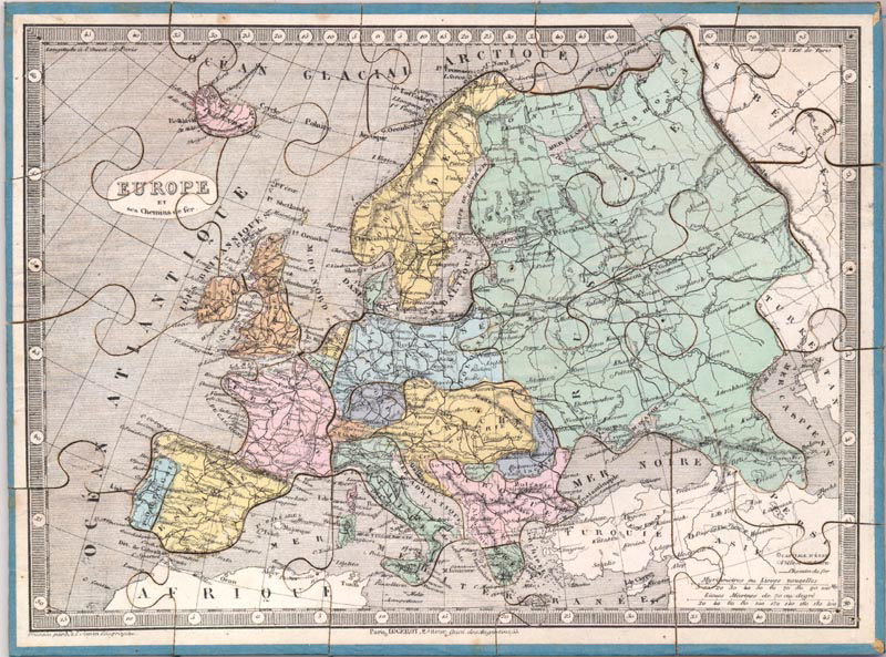
Puzzle & Game Maps Puzzle maps and game maps have been used for centuries as a fun and engaging way to teach geography to children. Both geographical games and puzzles were popular throughout Europe, particularly after the publication of influential treatises on education, such as John Locke's Some Thoughts Concerning Education (1693), which promoted the concept of using toys as teaching tools. The first mapmaker known to create a geographical board-game was Frenchman Pierre Duval around 1645. These initial games were typically in the style of the Game of the Goose, in which players move pieces around a numbered track (traditionally with 63 squares) in an attempt to reach the final square first. Although there is debate as to who created the first dissected map, or jigsaw puzzle, British cartographer John Spilsbury is commonly credited as the first commercial producer in the 1760s. These early puzzles were typically printed on paper, which was then pasted onto wood and dissected. (You can read our article about dissected maps for an in-depth review of this genre by clicking here.) The market for games and puzzles expanded in the 19th century as new production methods lowered prices, bringing more of these geographical teaching tools into classrooms and homes all over Europe.
A Game of the Goose beginning in London and ending in Athens.William Darton, Walker's New Geographical Game Exhibiting a Tour Through Europe, 1810.
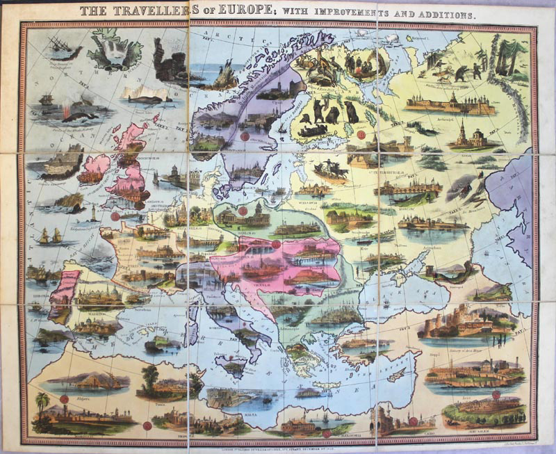
This game board is filled with vignettes of key cities, landmarks, and common activities of various regions. William Spooner, The Travellers of Europe; with Improvements and Additions, 1852.
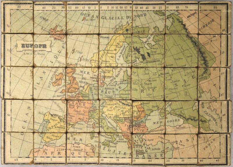
From a set of puzzles including puzzle maps of the world, Europe, and France.Auguste Logerot, Europe et ses Chemins de Fer, 1850.
A unique cube-shaped puzzle with maps of the world and continents featured on each side of the cube. Charles Verneau, Europe, 1890.
Stay Tuned Our cartographic expedition continues in August with an article about the mapping of Africa!
References
Baynton-Williams, Ashley, The Curious Map Book, University of Chicago Press, Chicago, 2015.
Heijden, H.A.M van der, De Oudste Gedrukte Kaarten van Europa, Alphen aan de Rijn: Canaletto, 1992