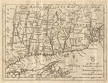
"A Map of Connecticut and Rhode Island, with Long Island Sound, &c.", Anon.
Subject: Colonial New England
Period: 1776 (dated)
Publication: Gentleman's Magazine
Color: Black & White
Size:
9 x 6.8 inches
22.9 x 17.3 cm
This is an interesting Revolutionary War period map with good detail throughout showing roads, villages and ports. Scale of British miles and simple compass rose. This is the last of a series of four maps that were issued in the Gentleman’s Magazine during 1776 to illustrate the growing unrest in the colonies. This example still bound into the complete November 1776 issue that includes much American news including a long account of the "proceedings of the American Colonists, since the passing of the Boston Port-Bill."
References: Jolly: GENT-249; Sellers & van Ee 819; Thompson #25.
Condition: A
Trace of offsetting, else fine.