Subject: South Pole, Antarctica
Period: 1597 (dated)
Publication: Descriptionis Ptolemaicae Augmentum
Color: Black & White
Size:
11.6 x 9.1 inches
29.5 x 23.1 cm
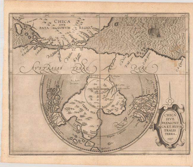
This scarce early map features Terra Australis, the great southern landmass thought to cover the South Pole and incorporate what would later be discovered to be Australia. Its cartography is based upon Mercator's 1569 wall map of the world, and was perpetuated by the likes of Ortelius, de Jode, Blaeu and numerous others until the concept was disproved by Cook in 1769. The map is divided into two parts. The upper section shows the tip of South America with the Spanish colony of Philippopolis, and the Strait of Magellan that separates it from Terra Australis. The lower map is presented on a polar projection that shows the huge Terra Australis, with promontories reaching towards Africa, Java and New Guinea. The kingdoms of Maletur, Lucach and Psitacorum (Land of the Parrots), and the place name Beach are located; nomenclature that continues to appear on subsequent maps of Australia. The sea is stipple engraved and includes an image of Magellan's ship Victoria entering the strait, which is named for him. It is further ornamented with a fine strapwork title cartouche.
References: Tooley (Australia) #1430; Mickwitz & Miekkavaara #307-2; Shirley (BL Atlases) T.WYT-1a.
Condition: B+
A dark impression on a faintly toned sheet with a coat of arms watermark, printer's ink residue, several small stains at right, and a narrow right margin. Small remnants of hinge tape on verso.


