Subject: Africa
Period: 1787 (circa)
Publication: Nieuwe Natuur-Geschieden Handelkundige Zak-En Reis-Atlas
Color: Hand Color
Size:
9.6 x 7.1 inches
24.4 x 18 cm
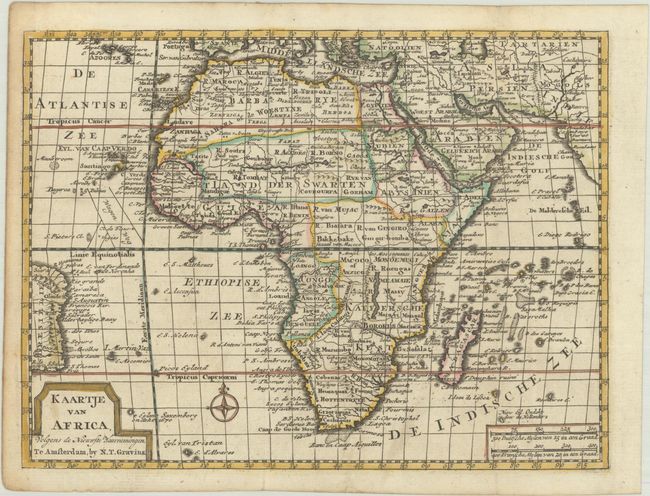
Nice small map of the continent of Africa that provides a concise look at the geographical knowledge prevalent in the late-eighteenth century. Numerous tribal territories are carefully outlined with major place names noted. The map extends to include a portion of the Brazilian coastline and the northeastern coastline of India. This map appeared in Gerrit Brender a Brandis' Nieuwe Natuur-Geschieden Handelkundige Zak-En Reis-Atlas, which was published by Nicholaes Theodorus Gravius. The atlas included many maps engraved by Jacob Keizer and published in pocket atlases by Jan de Lat, some of which were updated with new geographical information and with Gravius' imprint replacing that of Keizer and De Lat.
References:
Condition: A
A crisp impression with contemporary outline color, issued folding on a bright sheet with a fleur-de-lis watermark. There is a hint of offsetting and marginal toning.