Subject: World
Period: 1871 (circa)
Publication:
Color: Hand Color
Size:
37.7 x 27.1 inches
95.8 x 68.8 cm
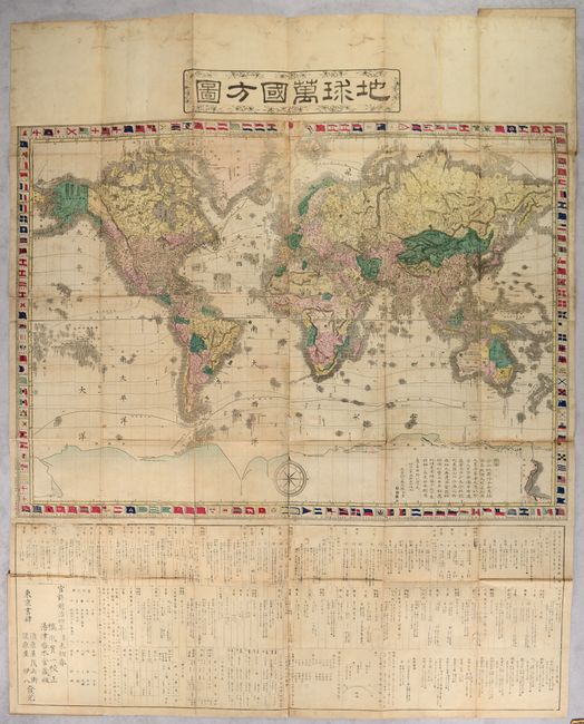
This large and elaborate Japanese map of the world is drawn on Mercator's Projection. Countries are shown in various hand colors and emphasizes physical features including topography and drainage. Numerous place names are identified along the coastlines throughout. Isothermal lines are drawn across the map and ocean current direction is indicated by small arrows. The map is surrounded by a decorative border featuring various national flags with Japan's flag placed at top center. A substantial section of text below the map provides country-level details including major cities, railroads, currencies and more. The text also notes that this map was based on one by Samuel Augustus Mitchell in 1870. Engraved by Matsuda Ryokuzan and published by Suharaya Mohei and Suharaya Ihachi in Tokyo. The full sheet measures 38.8 x 48.0". Self-folds into cloth covers (6.6 x 10.0").
References:
Condition: B
Issued folding with numerous worm tracks and worm holes throughout with some loss of image that have all been archivally closed on verso with Japanese tissue. There is moderate soiling. Covers are lightly worn and soiled.