Subject: Bahamas
Period: 1866 (dated)
Publication:
Color: Black & White
Size:
23.3 x 35.9 inches
59.2 x 91.2 cm
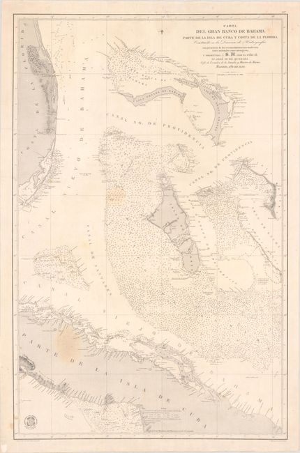
This is a scarce Spanish sea chart that delineates the banks off the east coast of Florida from Hutchinson Island to Key Largo, the Bahamas, and the central section of Cuba. The chart is quite detailed and includes all the tiny islands, meticulously noted soundings, and many hand colored light-houses. In Florida, Fort Jupiter, with its important lighthouse, is located, along with the tiny town of Miami (which would not be incorporated until 1896) and two other lighthouses. The map was originally published in 1858 under the auspices of the Direccion de Hydrografia by Quesado, who was the chief of cartography for the Ministry of the Navy, and updated to 1866. The embossed stamp of the "Direccion de Hidrografia" is in the lower left corner and includes their coat-of-arms.
References:
Condition: B+
On a bright watermarked sheet with a few light dampstains and a small hole in an unengraved area along the lower left border that has been infilled. Several small edge tears, including one that extends 2.5" into the image at upper left, have been closed on verso with archival tape. Map has been stored rolled and does not lay flat on its own.