Subject: Crescent City, California
Period: 1859 (dated)
Publication:
Color: Black & White
Size:
15.9 x 12.2 inches
40.4 x 31 cm
The Office of Coast Survey is the oldest U.S. scientific organization, dating from 1807 when Congress directed that a "survey of the coast" be carried out. By 1836, it was called the U.S. Coast Survey and in 1878, the name was changed to the U.S. Coast and Geodetic Survey. Today the Office of Coast Survey is a division of the National Oceanic and Atmospheric Administration NOAA.
The survey teams, composed of civilians as well as Army and Naval officers, charted the nation's waterways and produced a wide array of reports, survey charts, hydrographic studies of tides and currents, astronomical studies and observations, and coastal pilots. These charts are an important record of the changing nature of the nation's coastlines. In additional to coastal charts, the U.S. Coast and Geodetic Survey produced land sketches, Civil War battle maps, and the early aeronautical charts.
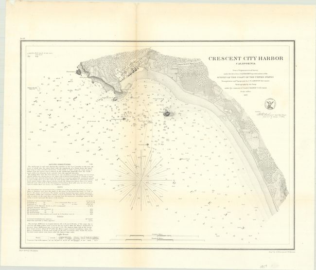
A detailed chart showing the street-grid pattern of Crescent City and the crescent-shaped coastline from which the city is named. The water is filled with navigational detail including soundings, bottom types, rocks, and islands with sailing directions in the lower left corner. Drawn by S.B. Linton and engraved by A. Petersen and F.W. Benner.
References:
Condition: B+
Issued folding and now flattened and backed with tissue. There is faint toning along the folds and a tiny tear and fold separation along the vertical fold.