Subject: Western Nevada
Period: 1879 (circa)
Publication:
Color: Black & White
Size:
17.9 x 21.6 inches
45.5 x 54.9 cm
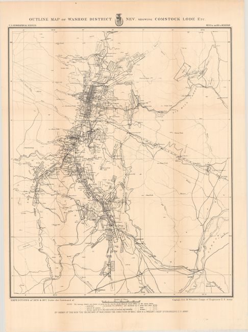
This remarkably detailed map shows the gold and silver operations in the vicinity of Virginia City. The map is a product of Capt. G.M. Wheeler's Expeditions of 1876-77 for the "Surveys West of the 100th Meridian." It is difficult to overstate the number of claims shown; perhaps as many as 100 in a patchwork mosaic cover the region so completely it is difficult to see place names. Scores of mills including Sherman, French's, Humphreys, Nevada and many more are identified. The Sutro Tunnel is detailed with the tunnel entrance located. Hundreds of settlements and villages, roads and trails, and more are presented. This area first drew the interest of gold prospectors in the 1850s. They struggled with the heavy, gooey mud that clung to picks and shovels. When assayed, this troublesome muck proved to contain silver ore worth over $2,000 a ton - in 1859 dollars - not counting the gold content! This rich lode caught the attention of President Lincoln who realized this mineral wealth could help keep the Union solvent during the Civil War. In 1864 he made Nevada a state, bypassing the sticky problem that it did not contain enough people to be constitutionally eligible for statehood. A remarkable map that attests to the manic mining activities of the day.
References:
Condition: B+
Issued folding and now flattened and backed with tissue. There is minor toning along the folds.