Subject: Atlases
Period: 1750 (circa)
Publication:
Color: Hand Color
Size:
11.4 x 9.2 inches
29 x 23.4 cm
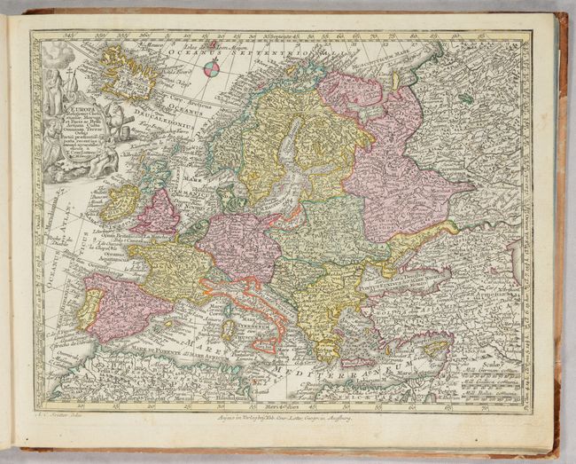
This composite atlas includes 20 maps by Lotter, some drawn by Seutter, as well as 8 unrelated maps tipped in at the end of the volume. In addition to the world and five continents, there are maps of Spain & Portugal, France, Britain, Low Countries, Italy, Switzerland, Central Europe, Bohemia, Scandinavia, Baltic States, Hungary, Russia, Middle East, and Holy Land. Of key interest are the following maps:
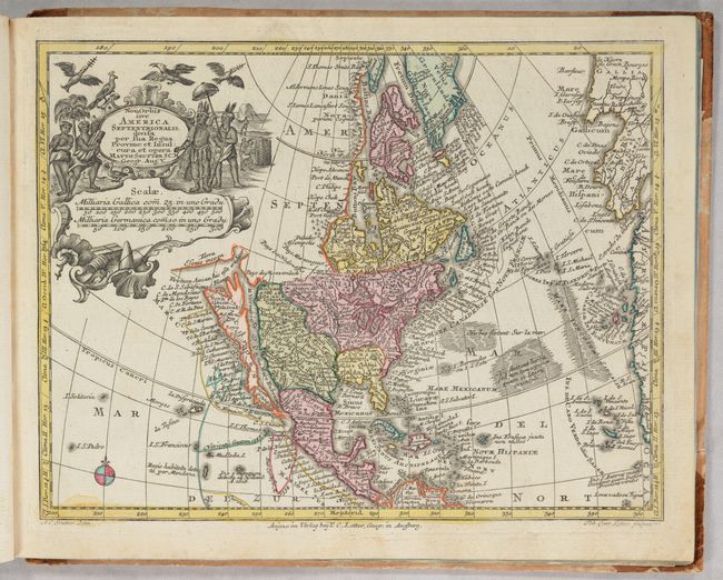
Nova Orbis sive America Septentrionalis. A superb small map with California as an island on the second Sanson model, showing two bays on the north end of the island. The island is also very narrow in the center, almost becoming two islands, a theory proposed by Father Luis Velarde. The map is densely covered with place names, and the northern extremes are strangely elongated. The large title cartouche, surrounded by Native Americans and birds conveniently obscures the northwest coast with the exception of a portion of the Terra Esonis incogn.
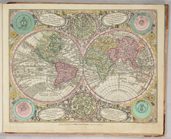
Diversi Globi Terr-Aquei. This is the reduced edition after Seutter's larger and beautiful map that is considered one of the most graphic 18th century world maps. California is an Island and Japan is shown in a bizarre shape that incorporates the fictional Terra Yedso. An elongated stretch of land, Terra Esonis, extends from Japan to California. The map is filled with detail including the tracks of several explorers. Between the hemispheres are celestial charts of the northern and southern skies, while diagrams of the solar system based on the theories of Ptolemy, Copernicus, Descartes and Tycho Brahe fill the corners. It is set in a richly engraved background of clouds with numerous wind heads and four cartouches. Engraved by Andrea Silbereisen.
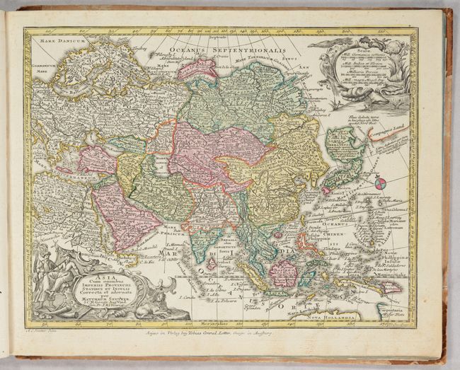
Asia cum Omnibus Imperiis Provinciis, Statibus et Insulis. Charming reduced version of this German map covers the continent and the East Indies. Terra Yedso is represented here as a large landmass to the north of Japan (Honshu) and linked by a narrow causeway. Compagnie Land is shown to the east and marked with a notation that is was discovered by Don Iean de Gama. There is no Kamchatka peninsula and Nova Zembla appears to be a peninsula rather than an island. The cartouche represents the exotic East with people and animals.
Africa Juxta Navigationes et Observat. Handsome map displaying Seutter's strong style. The map is packed with detail - much of it fictitious. The Nile is shown not only originating in twin lakes, but also continuing further south nearly to the tip of the continent. A lake joins the Senegal and Niger Rivers. The large, cartouche is beautifully engraved and surrounded by natives and exotic animals including a large winged dragon.
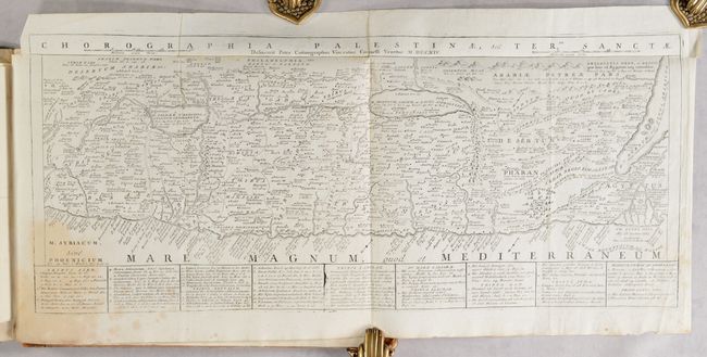
This composite atlas does not include a title page. At the end of the volume are 8 black and white maps, including: small, anonymous maps of the Low Countries and the Middle East; a large folding map of the Holy Land (anonymous but attributed to Coronelli and dated 1714); two anonymous miniature maps of France and Paris; and three miniature maps of Corsica and regions in Italy from Pietro Zancon's L'Italia Divisa Ne'Suoi Stati (1794).
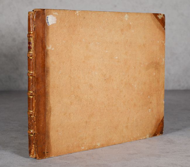
Oblong octavo with 28 maps. There is no list of maps. Hardbound in quarter leather with tips over orange paper-covered boards; raised bands on spine with red leather title label; and marbled pastedowns.
References: McLaughlin #221; Phillips (Atlases) #3492; Yeo #133.
Condition: A
Condition code is for the Seutter/Lotter maps, which are in full contemporary color with occasional minor soiling or foxing. The maps of Scandinavia and the Baltic States have a small ink stain at center. Four of the additional black and white maps are in "A" condition. The large folding map of the Holy Land is in "B+ condition with a stain at bottom left. Zancon's three miniature maps are in "B" condition with soiling and small chips; these maps were previously pasted onto a sheet at the end of the volume but are now detached. There is a previous owner's bookplate on the inside front pastedown. The covers are worn and stained with bumped corners and small abrasions. The spine is also worn with a bit of worm damage and the leather title label is partially missing.