Catalog Archive
Auction 194, Lot 44

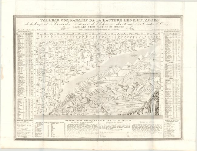
"Tableau Comparatif de la Hauteur des Montagnes de la Longueur du Cours des Fleuves et de l'Elevation des Principales Chutes d'Eaux...", Monin, Charles V.

Subject: Cartographic Miscellany, Mountains & Rivers

Period: 1839 (circa)

Publication: Atlas Classique de la Geographie Ancienne...

Color: Black & White

Size:
23.8 x 17.8 inches
60.5 x 45.2 cm
Download High Resolution Image
(or just click on image to launch the Zoom viewer)

This beautifully engraved thematic chart compares the relative size of the world's mountains and rivers. Many 19th-century cartographers presented some form of this design in their work, but this example is larger and more fully engraved than most others. It also includes the uncommon presentation of the relative heights of waterfalls. The rivers are aligned at upper left with the mountains and volcanoes filling the lower right with the major cities noted throughout with their elevations noted on the mountain portion. At the sides extensive tables give more detail on each feature.

References: Rumsey #2613F.

Condition: A

Issued folding on a bright sheet with minor offsetting and very faint dampstaining that enters into the text at bottom.

Estimate: $140 - $170

Sold for: $90

Closed on 9/13/2023

Archived