Subject: Colonial North America
Period: 1754 (dated)
Publication:
Color: Hand Color
Size:
11.1 x 8.1 inches
28.2 x 20.6 cm
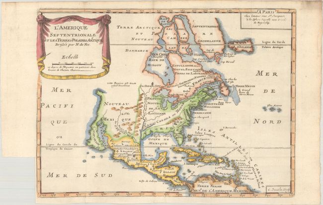
This is a rare late edition of De Fer's map of the continent with a fascinating history. The first edition of this map was published in 1693 and showed California as an island. After Nicolas de Fer's death in 1720, the plate was passed on to his sons-in-law, Guillaume Danet and Jacques-Francois Benard. Danet's wife took over the business upon her husband's death, and upon her death in 1746, her daughter, Marie-Anne, acquired the business with her husband, Nicolas-Jean-Baptiste Desbois. Mr. Desbois died in 1749, at which point Marie-Anne Desbois succeeded her husband, publishing a final edition of this map, dated 1754. Other than updating the publisher's imprint at top right, the only other change that was made was to the depiction of California, which was revised into a peninsular shape with a very narrow neck. Other key details remained the same, including Lake Ontario forming the headwaters of the St. Lawrence River, leaving the other Great Lakes landlocked. The eastern coast includes the names of Boston, New York, Providence, Chesapeake Bay, Virginia, Carolina, and Florida. The title is displayed on a drape-style cartouche. Engraved by C. Inselin.
References: cf. Burden #696.
Condition: A
A crisp impression issued folding on a bright, watermarked sheet with a binding trim at bottom left and marginal soiling at top right.


