Subject: Western Hemisphere - America
Period: 1709 (circa)
Publication:
Color: Hand Color
Size:
23.3 x 19.8 inches
59.2 x 50.3 cm
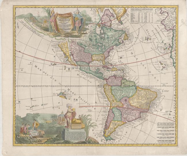
This uncommon map of the Americas, engraved by A.F. Zurner, is based largely on the cartography of Visscher and Sanson. California is shown as an island with an indented northern coast on the Sanson model with the inclusion of three place names in Southern California: S. Isidoro, Gigante and N S del la Guadalupe. In South America, the mythical lakes Parima Lac and Xarayes still appear. The map is embellished with two superb pictorial cartouches. The title cartouche, flanked by two Native Americans, conveniently hides Terra Esonis Incognita that stretches out towards Asia and the Fretum Anian that separates it from California. Latin text enclosed in the cartouche discusses the explorations of Columbus and Vesputius, and the Catholic missions. The large vignette at bottom shows explorers seated around a table, natives worshiping in a temple, a battle, and the allegorical figure of America displaying the wealth of the hemisphere.
References: McLaughlin #166; Tooley (America) p.128, #67, plt #52; Wagner (NW) #490.
Condition: B+
A nice impression on a bright sheet with a bit of creasing in the top margin, some soiling at bottom right, and a couple of minor tears south of Brazil that have been professionally repaired. There are some tiny tears along the edges of the sheet that have been archivally repaired.