Subject: Western Hemisphere - America
Period: 1828 (dated)
Publication:
Color: Hand Color
Size:
29.7 x 22.8 inches
75.4 x 57.9 cm
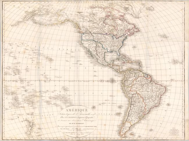
This large French map of the Americas is based on the earlier four-sheet map of the continent by Aaron Arrowsmith with additional information from Humbodlt’s expedition as well as the discoveries of Clarke, Pike, Franklin and Parry. In North America, the United States features large Missouri and Oregon territories with numerous Indian tribes named. The spurious R. S. Felipe crosses the Great Basin linking Lake Teguyo with the San Francisco Bay. Texas is named and shown under Spanish control, while Alaska is Amerique Russe. There is good inland detail in both North and South America, depicting numerous towns and cities, rivers and topography. Numerous islands in the South Pacific, including New Zealand, are located and identified.
References:
Condition: B+
Issued folding on sturdy paper with light scattered foxing. Trimmed close to the border at top and bottom, likely by the binder.