Subject: Indian Ocean
Period: 1690 (circa)
Publication:
Color: Hand Color
Size:
34.8 x 23.5 inches
88.4 x 59.7 cm
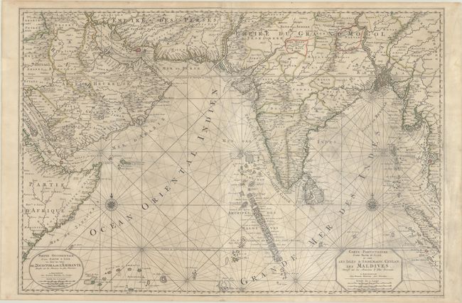
This is a superb, two-sheet map covers the Indian Ocean and the adjacent coastlines from the Horn of Africa to Sumatra. It includes all of India and remarkable detail, particularly along the coasts. Each sheet is centered on a boldly engraved compass rose. A major focus of the map are the islands in the Indian Ocean including Zocotora (Socotra), the Amirante Islands (Seychelles), the Maldives, Ceylon (Sri Lanka) and the Andaman Islands. The western sheet is titled in Dutch and the eastern sheet is titled in French. The maps were also issued separately, and are much less common in the joined state, which appeared in both the Atlas Nouveau and the Suite du Neptune Francois.
References: Tibbetts #164.
Condition: B+
A crisp impression with contemporary outline color, light soiling and some dampstaining. Professionally backed in thin, archival tissue to repair some short tears caused by the dampstains in the right-hand sheet, as well as a couple of small holes with a minute amount of the image replaced in facsimile.