Subject: World
Period: 1770 (circa)
Publication: Atlas Minor
Color: Hand Color
Size:
10.1 x 7.6 inches
25.7 x 19.3 cm
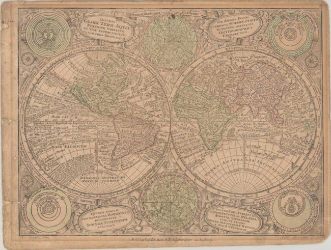
This is the reduced edition after Seutter's larger and beautiful map that is considered one of the most graphic 18th century world maps. California is an Island and Japan is shown in a bizarre shape that incorporates the fictional Terra Yedso. An elongated stretch of land, Terra Esonis, extends from Japan to California. The map is filled with detail including the tracks of several explorers. Between the hemispheres are celestial charts of the northern and southern skies, while diagrams of the solar system based on the theories of Ptolemy, Copernicus, Descartes and Tycho Brahe fill the corners. It is set in a richly engraved background of clouds with numerous wind heads and four cartouches. Engraved by Andrea Silbereisen.
References:
Condition: B
A slightly faded impression with full contemporary color on a toned sheet that is double-thick. There is light soiling, binding holes in the left blank margin, and chips in the corners of the sheet.