Subject: Western United States
Period: 1850 (circa)
Publication: Corso di Geografia Commerciale
Color: Hand Color
Size:
10.9 x 13.2 inches
27.7 x 33.5 cm
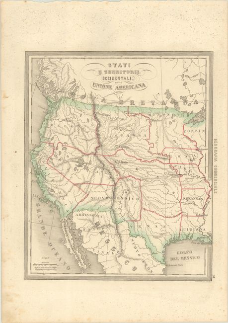
This very scarce Italian map illustrates the western part of the United States. The map shows the region with a pre-Gadsden Purchase border with Mexico, and all the states and territories have irregular shapes. A large Kasas territory covers present-day Oklahoma, Kansas and Nebraska. In the Pacific Northwest, there is a large Oregonia territory that covers Washington, Oregon and Idaho. < I>Yutah envelopes the Gran Iago Salato (Great Salt Lake) and the headwaters of a spurious river that flows through the Great Basin to the Pacific. One of the most interesting features of the map is the region labeled Arrissonia below the Gila River. This is one of the earliest notations regarding Arizona.
References:
Condition: B+
A nice impression with contemporary outline color. There are tiny mildew spots mostly in the blank margins.