Subject: Exploration and Surveys
Period: 1749 (published)
Publication:
Color: Black & White
Size:
8.1 x 10.3 inches
20.6 x 26.2 cm
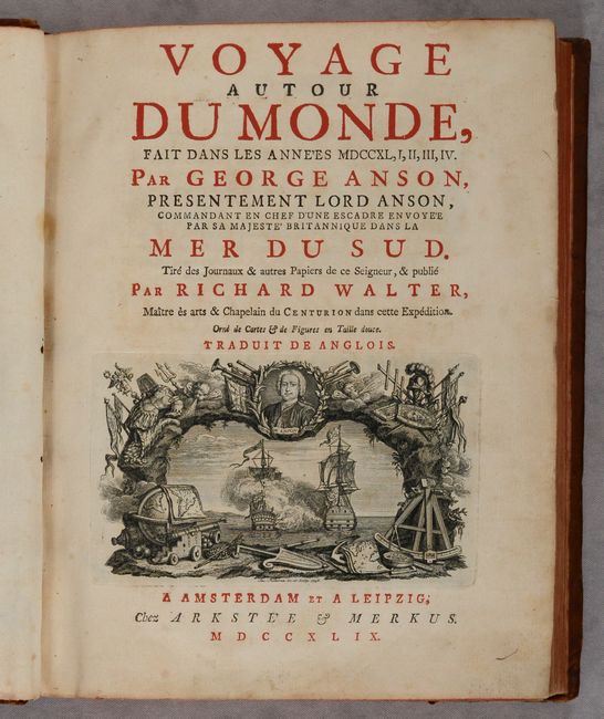
This is a French edition of Anson's work describing his voyage around the world. In 1740, George Anson set sail in command of a squadron sent to attack Spanish possessions and interests in South America. The expedition was ill-equipped and failed to carry out its original ambitious mission. By June 1741 when Anson reached Juan Fernandes, his force had been reduced to only three of the original six ships, while the strength of his crews had fallen from 961 to 335. After launching several attacks on the west coast of South America and recuperating on the island he collected the remaining survivors on his flagship, the Centurion, and set sail in search of one of the richly laden galleons that conducted the trade between Mexico and the Philippines. The indomitable perseverance he had shown during one of the most arduous voyages in the history of sea adventure gained the reward of the capture of an immensely rich prize, the Nuestra Señora de Covadonga, which he encountered off Cape Espiritu Santo on June 20, 1743. From here he sailed back to Canton before traveling through Southeast Asia and around the southern tip of Africa. He made his way back to England, arriving in Spithead in June 1744.
This quarto version includes 34 plates including 14 maps and charts depicting his voyage. Of particular interest are the following three large folding maps:
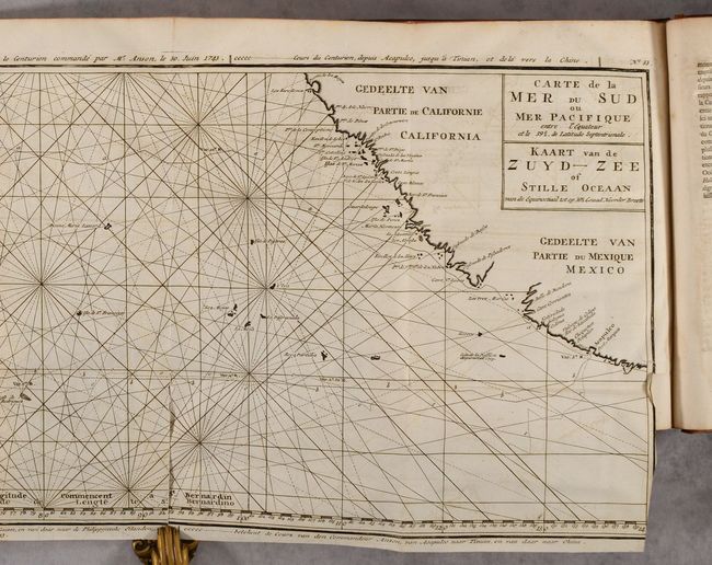
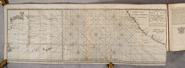
Carte de la Mer du Sud ou Mer Pacifique (33.5 x 10.7"). This unusual chart joined on two sheets details the route of Spanish galleons between the Philippines and Acapulco. The tracks of British Navy Commodore George Anson and Spanish Nostra Seigniora de Cabadonga are shown. A somewhat speculative depiction of the islands of Japan is shown at top left. Condition: There is a 3" fold separation at bottom and a small binding tear at right.
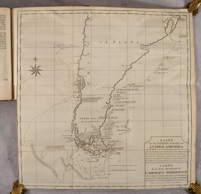
Carte de la Partie Meridionale de l'Amerique Meridionale... (18.9 x 19.4"). This handsome chart shows the route of Capt. George Anson's expedition from St. Catherine's Island off the coast of Brazil, around Cape Horn and up to Juan Fernandes Island (now known as Robinson Crusoe Island) off the coast of Chili. The chart shows numerous calculations of water depth, ocean currents, and includes navigational notes. A decorative compass rose with fleur-de-lys is positioned in the sea. Condition: There is a 2" binding tear at left.
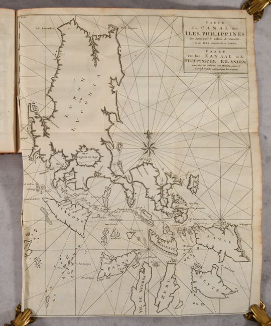
Carte du Canal des Iles Philippines... (16.1 x 20.9"). This chart of the Philippine Islands spans from Luzon to Leyte. The focus of the chart is on the track of the Manila Galleon from the Mole of Cabite until it is clear of land, north of Samal. Condition: There is minor foxing. Trimmed to the neatline at left by the bookbinder, with left edge of sheet a bit crumpled with tiny tears due to misfolding.
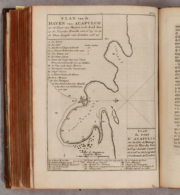
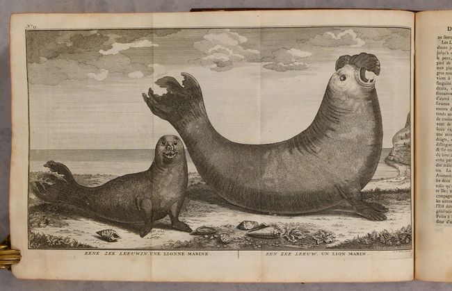
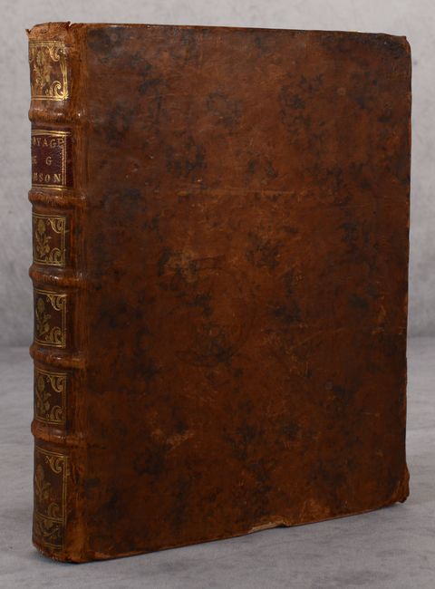
The remaining plates include coastal views, naval battles, land views, and an interesting plate depicting a pair of sea lions. Title, dedication, contents, introduction, 331 pages of text, errata, and directions to the binder. Hardbound in full contemporary leather with raised bands, gilt tooling, and red leather title label on spine; marbled endpapers.
References:
Condition: B+
Most of the text and plates are clean and bright. Details on the three large folding maps have been noted above. Some of the pages and plates towards the front and back of the volume have light toning and foxing. The front free-endpaper is chipped and torn. The hinges are starting. The covers are worn with bumped corners, a few small chips to the leather, and some abrasions. The spine is lightly worn and cracking.