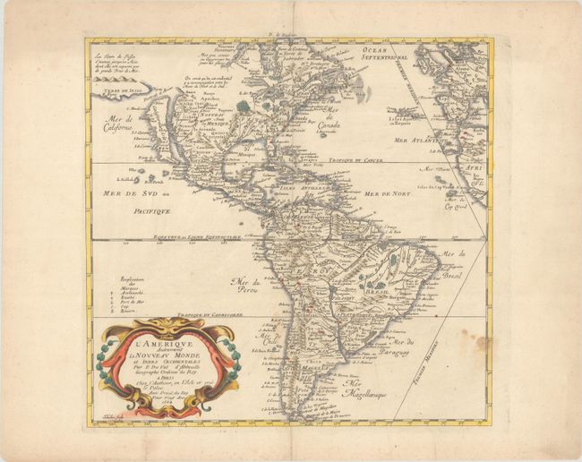
Subject: Western Hemisphere - America
Period: 1664 (dated)
Publication: Cartes de Geographie...
Color: Hand Color
Size:
15.1 x 14.5 inches
38.4 x 36.8 cm
This uncommon map of the Americas is based largely on the cartography of Nicolas Sanson, Duval's uncle. In North America, the Great Lakes are shown open-ended in the west and California is depicted as an island. Above California is the Destroit d' Anien and the large Terre de Iesso, or land of Jesso, that was the result of confusing reports by De Vries on his expedition in the waters north of Japan. Several colonial settlements appear on the eastern seaboard including Iamestoun, Christina, London al: Boston, N. Amsterdam al: Manhate. In South America, the mythical Parime Lake is located in Guiana with its legendary Manoa-el dorado (City of Gold). There is good detail of the missions. The map includes the western coasts of Europe and Africa and the Prime Meridian goes through the Isle de Fer. The map was originally engraved in 1655 and appeared in several states until Duval's death in 1683. Engraved by Jan L'Huilier.
References: Burden #311 (State 4); McLaughlin #15 (State 3).
Condition: B+
On watermarked paper with some minor staining. Centerfold separations confined to the top and bottom blank margins have been closed on verso with old paper.