Catalog Archive
Auction 189, Lot 502

"Carte Generale des Etats du Czar Empereur de Moscovie, ou l'on voite ce que ce Prince Possede en Europe et les Etats qu'il Possede en Asie...", Chatelain, Henry Abraham

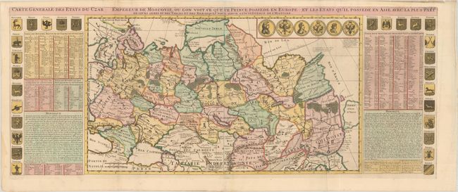
Subject: Russia, Eastern Europe & Central Asia

Period: 1720 (circa)

Publication: Atlas Historique

Color: Hand Color

Size:
38.5 x 15.1 inches
97.8 x 38.4 cm
Download High Resolution Image
(or just click on image to launch the Zoom viewer)

This is a grand map of the Russian Empire extending from Finland to Siberia and Tartary. "Ukraine Pays des Cosaques" is noted north of Crimea within the region of Moscovie Europeane. Novaya Zemlya is shown connected to the mainland. Just below the Arctic Circle, Witsen's mountainous peninsula is shown with an unknown eastern coastline. The eastern coastline, with Terre d' Eso d'Yeco, is depicted via faint engraved lines and there is no Kamchatka Peninsula. The map is flanked by panels of French text with historical notes, the provincial coats-of-arms, and six medallions. Printed on two joined sheets, as issued.

References:

Condition: B+

A nice impression on a sheet with a Strasbourg bend and lily watermark. There is light extraneous creasing and dampstains along the left edge of the sheet.

Estimate: $600 - $750

Sold for: $450

Closed on 9/14/2022

Archived