Catalog Archive
Auction 189, Lot 403

"Pas-Caerte van Texel tot Aende Hoofden, Begrypende in sich de Zee-Custen van Vries-Land...", Loon, Jan van
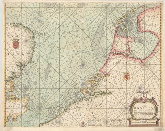
Subject: North Sea

Period: 1661 (circa)

Publication: Klaer Lichtende Noort-Star ofte Zee Atlas...

Color: Hand Color

Size:
21.8 x 17 inches
55.4 x 43.2 cm
Download High Resolution Image
(or just click on image to launch the Zoom viewer)

This handsome coastal chart details the North Sea between England and the Netherlands. The Frisian Islands are shown along the coast of Holland to just south of Dunkerque. The English coast is well detailed and includes the royal arms of England. The sea is full of rhumb lines, soundings, and shoals. Adorned with a strapwork title cartouche.

References: Shirley (BL Atlases) M.LOON-1a.

Condition: A

A crisp impression on a bright sheet, professionally remargined at top and bottom with a minor amount of the neatline replaced in facsimile.

Estimate: $700 - $850

Unsold

Closed on 9/14/2022

Archived