Catalog Archive
Auction 189, Lot 280

"Land Togten door Ferdinand Cortes aan de Golf van Nieuw Spanje, ter Bemagtiging van Tlascale Mexico en Aangrenzende Landschappen Gedaan", Aa, Pieter van der
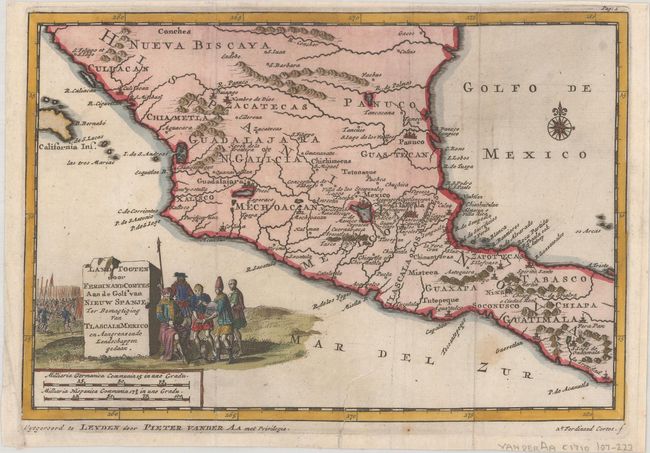
Subject: Mexico

Period: 1710 (circa)

Publication: Naauwkeurige Versameling der Gedenk-Waardigste Zee en Landreysen…

Color: Hand Color

Size:
8.7 x 5.9 inches
22.1 x 15 cm
Download High Resolution Image
(or just click on image to launch the Zoom viewer)

This finely engraved map of central Mexico was designed to illustrate the expedition of Hernan Cortes (here called Ferdinand Cortes), a Spanish Conquistador who conquered Mexico circa 1520 and caused the fall of the Aztec Empire. The map depicts Guadalajara and Mexico City both situated on large lakes. The title cartouche includes a scene of natives bringing treasures to Cortes. This map was published in van der Aa's compilation of early voyages of exploration.

References: cf. Shirley (BL Atlases) G.AA-1a #40.

Condition: B+

A dark impression, issued folding with a couple of faint spots and a tear entering map 1" at bottom that has been closed with archival tape.

Estimate: $160 - $190

Sold for: $120

Closed on 9/14/2022

Archived