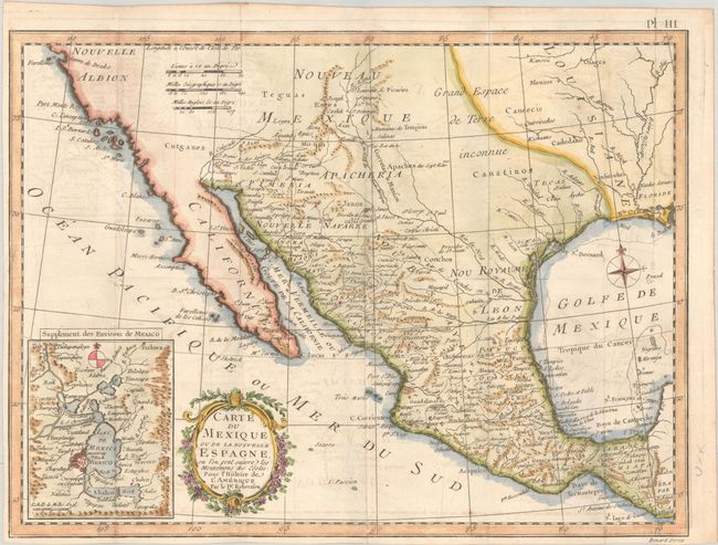
"Carte du Mexique ou de la Nouvelle Espagne, ou l'on Peut Suivre les Mouvemens des Costes, pour l'Histoire de l'Amerique par le Dr. Robertson", Kitchin, Thomas
Subject: Southwestern United States & Mexico
Period: 1778 (circa)
Publication: Histoire de l'Amerique
Color: Hand Color
Size:
15.1 x 11.3 inches
38.4 x 28.7 cm
This is a French version of Kitchin's Mexico or New Spain in which the Motions of Cortes may be traced. California is labeled New Albion (Nouvelle Albion) with no detail outside of a few coastal place names. The region of present-day Arizona and New Mexico is well delineated with numerous Indian villages and the locations of missions. The area from New Mexico to Louisiana is named as "Great Space of Land Unknown." The small Texas settlement of Cenis is north of the Nou. Royaume de Leon. An inset shows Mexico City on the large Lake of Mexico. Finely engraved with a decorative title cartouche and compass rose. Engraved by Benard.
References: cf. Wheat (TMW) #172.
Condition: B+
Issued folding on a sturdy sheet with light offsetting and narrow margins at left and bottom.