Subject: Southern Africa & Madagascar
Period: 1708 (dated)
Publication:
Color: Hand Color
Size:
24.3 x 19.2 inches
61.7 x 48.8 cm
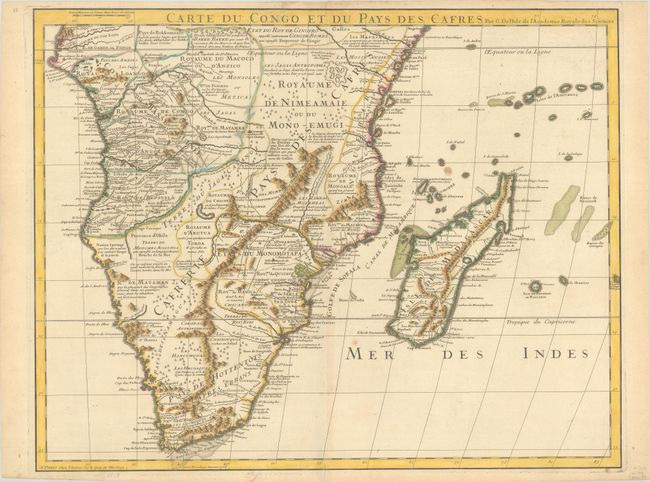
This is Delisle's meticulously detailed map of Southern Africa. It is emblematic of all Delisle's works, distinguished by his scientific approach to cartography. His work was the basis of most African maps made in the 18th century. The map covers Africa south of the Equator and includes Madagascar and several islands in the Indian Ocean. It is filled with information concerning European trade, native kingdoms and mineral wealth.
References:
Condition: B+
Contemporary outline color with some modern color that has been added to the mountains and shoals, on a sheet with the watermark of a Maltese cross encircled in rosary beads. There are a couple of spots of foxing and light toning along the edges of the sheet.